First, I would like to acknowledge both the Boon Wurrung peoples of the Kulin Nations and the Brataualung people of the Gunaikurnai Nations as the traditional owners of Wilsons Promontory National Park. I want to pay my respects to the past, present and any Indigenous people among us today. I also want to acknowledge that I have profited and benefited from stolen land and that Indigenous people were never ceded sovereignty. Finally, I would like to acknowledge the Wurundjeri peoples of, Naarm, where I sit and write this blog and would like to acknowledge the traditional owners of the many lands my readers come from.
Wilsons Prom is an extraordinary place. It is unique because the National Park is protected by only one vehicle access point in and out. It’s surrounded by coast and only one main section is actually used for public camping and vehicle access. This means that there is plenty of flora and fauna to discover. I would recommend staying overnight due to the distance from Naarm being 2.5 hours away and the plethora of things to do and see. They do have many different accommodation options including hike-in/out sites, powered and unpowered vehicle access sites and lodges/cabin options as well. It is an excellent venue for solo, couple, family and friend trips. There are many walks ranging from beach strolls, explorative walks, challenging hikes and experienced orienteering. Mount Bishop is a popular walk that can be accessed by Lilly Pilly Gully Carpark or from Tidal
River itself. I have walked this track many times but one of my favorite routes is from Tidal River to Mount Bishop via the Lilly Pilly Tracks.
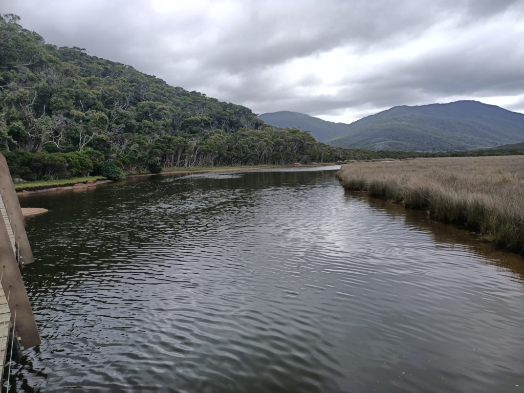
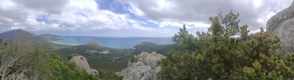
Starting at the footbridge across Tidal River we began walking the Tidal Overlook Circuit which contours around Tidal Overlook (153m) and is stunning. We got to enjoy river views all the way along. First walking through thick brush which then opens up into low-lying shrubbery as the terrain starts to flatten out on the edge of a saddle. Here the trail splits and you can choose to continue on the Overlook Circuit to the southwest or start the Lilly Pilly Link Track continuing northwest. We continued onto the Lilly Pilly Link for another 200m until we met up with the Wilsons Promontory Rd. Be aware of vehicles here they tend to drive fast along this road so be careful crossing.
After crossing the road, we arrived at the Lilly Pilly Gully Carpark there are toilets here for a well-earned break. There are two Lilly Pilly Circuit trail entrances here. We took the east trail entrance but you can take the west entrance because that is a shorter walk (1.5km instead of 3.6km) towards Mount Bishop if you want a more direct route. Although you will miss out on the boardwalk (an additional 500m) if you don’t continue along the circuit on your descent. We walked through the lush rainforest following educational signs along the way about the unique flora and fauna of this temperate rainforest. Highly recommend taking the time to read this information. The eastern side of the circuit is mostly flat contouring the edge of Mount Bishop until we got to the boardwalk. Here we followed a mini loop of the rainforest and explored more of the habitat. After the boardwalk, the trail began to climb towards Mount Bishop in a northwesterly direction.
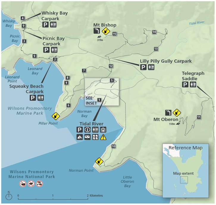
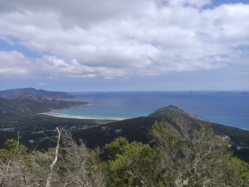
The trail goes over a couple of bridges and then once it changes to a southwest direction just below an implied knoll we saw another fork in the trail. You have the option to climb up to the summit of Mount Bishop or continue on the Lilly Pilly Circuit and arrive back at the car park. We chose to walk up Mount Bishop, this is a challenging but short summit only 1.9km with an elevation gain of 140m. We did see a snake last time we hiked up this trail so please stay aware of your surroundings and let passersby know. There are two vantage points at the top of Mount Bishop one that shows the beautiful inland rolling hills and snaking river and one that shows the spectacular coastline. The first point of relaxation was a large smooth boulder where the land unfolds in front of our eyes. Then continuing on we passed a bench to take in the experience and after about 150m, from the previous viewpoint, we found a cluster of smaller boulders with views of the ocean.
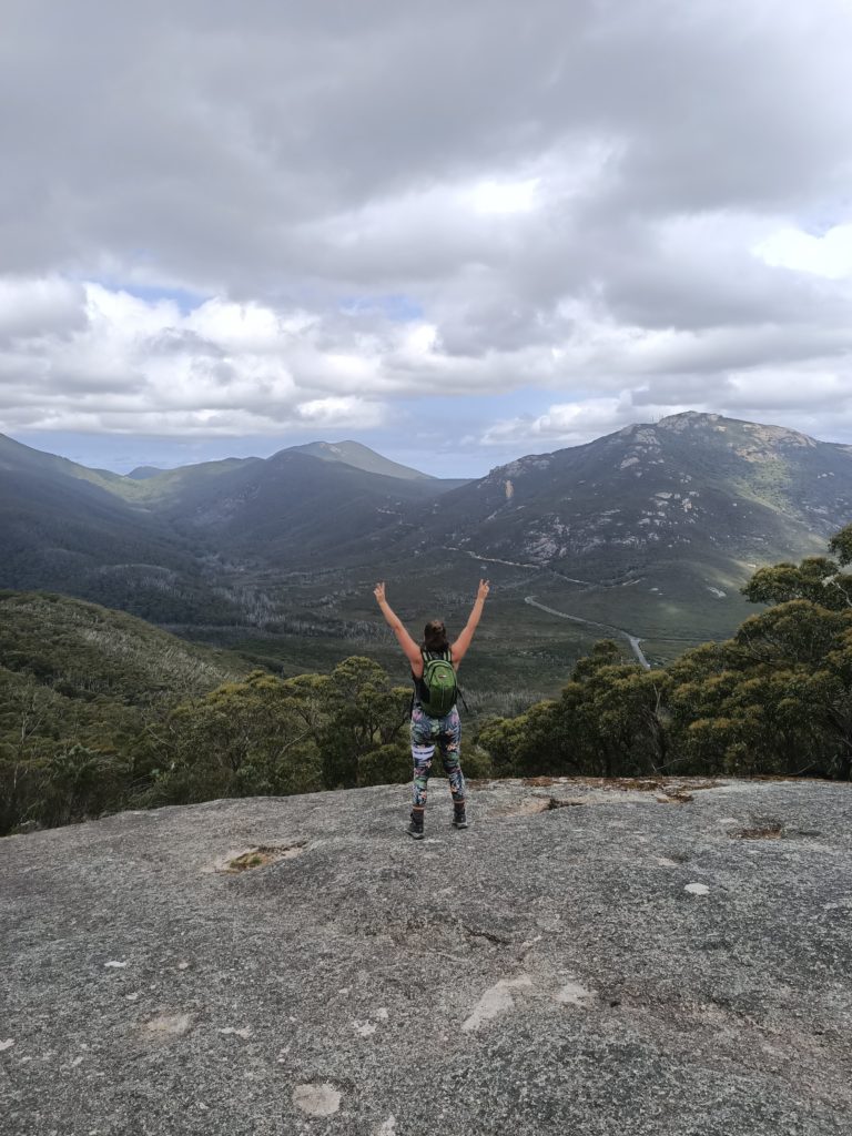
I have had picnics on the large smooth boulder looking out on the land many times, it is large enough for multiple groups to have their own space. We descended in the same manner that we had trekked up, there is only one trail. Then at the fork below the implied knoll, we took the Lilly Pilly Track to the southwest and found ourselves back at the Lilly Pilly Gully Carpark. Very convenient for another toilet break. We continued trekking back along the Lilly Pilly Link Track and onto the Tidal Overlook Circuit taking a southerly turn onto the bridge. This is a decent length trek for a half-day hike and still has many options for additions if you chose to include the rest of the Overlook Circuit (3km) which returns to the tidal river footbridge from the other side. Yet again similarly to the Yarra Bend Park, this entanglement of trails has a very much choose-your-own-adventure style experience.
| Trail Name | Tidal River Footbridge to the Mount Bishop Summit via Tidal Overlook Circuit, Lilly Pilly Link Track and Lilly Pilly Circuit |
| Distance | Tidal Overlook Circuit 3.8km (the section we did was 1.4km return) Lilly Pilly Link Track 400m (return) Lilly Pilly Circuit 5.8km Mount Bishop Summit 3.75km (return) TOTAL 11.35km (with full Overlook Circuit 13.75km) |
| Estimated Time | 4hrs |
| Grade | 3 |
| Type | Circuit |
| Park | Wilsons Promontory National Park |
| Access | 2WD |