We went to Bright with our friends to celebrate 3 birthdays. On Sunday, May 21 we visited Mt Buffalo National Park.
It was a cold and gloomy morning but by the time we arrived to Cresta Valley it started to clear up. The Horn was completely covered in fog / clouds so we decided to go to the Cathedral and Hump instead.
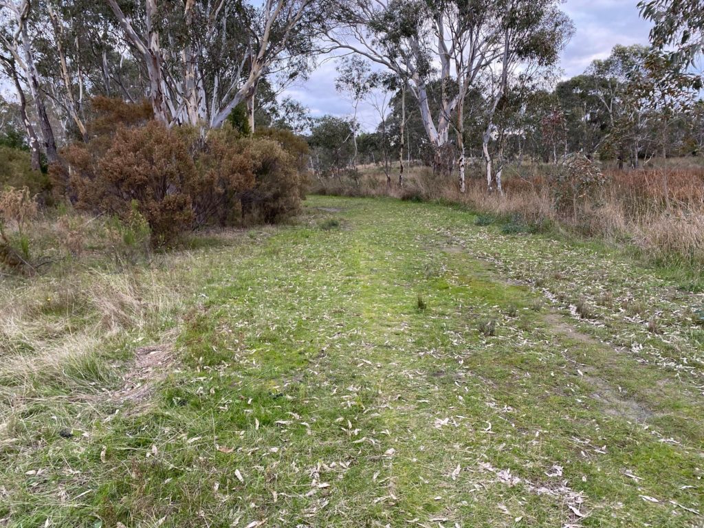
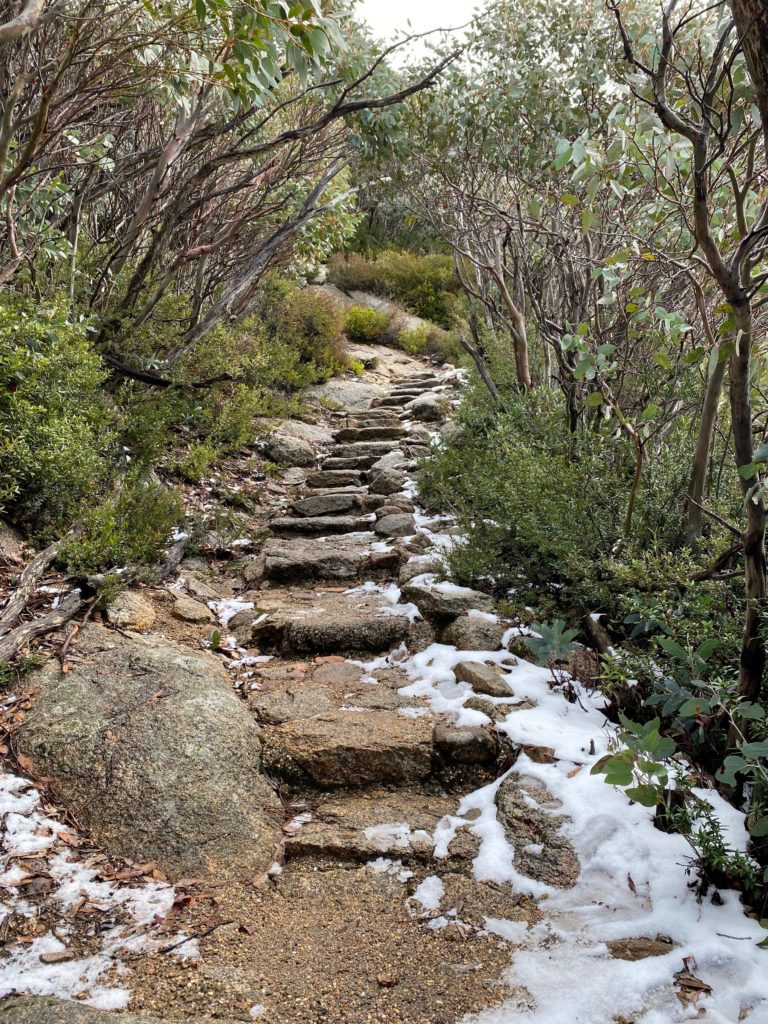
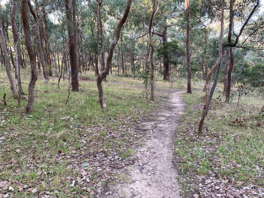
The trail started from a little car park on the Mt Buffalo Road. There were a toilet and a couple of picnic tables there. I was surprised to see some snow there:
Steps with some snow
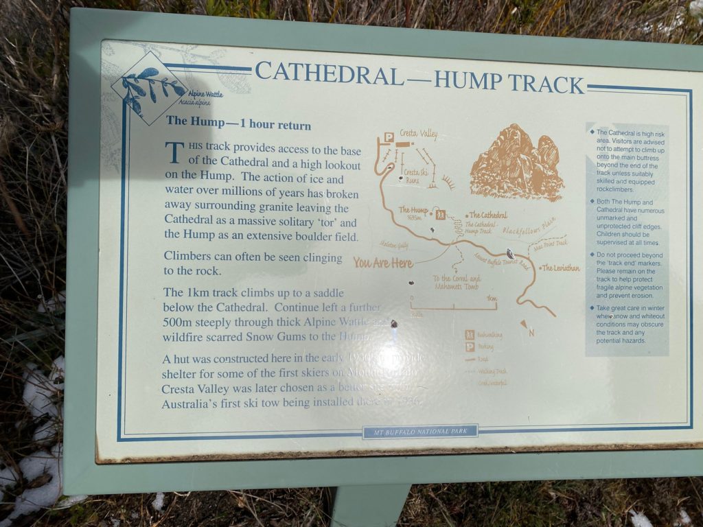
The sign reads:
The Hump -1 hour return
This track provides access to the base Tof the Cathedral and a high lookout on the Hump. The action of ice and water over millions of years has broken away surrounding granite leaving the Cathedral as a massive solitary ‘tor’ and the Hump as an extensive boulder field.
Climbers can often be seen clinging to the rock. The 1km track climbs up to a saddle below the Cathedral. Continue left a further 500m steeply through thick Alpine Wattle wildfire scarred Snow Gums to the Hump.
A hut was constructed here in the early 1930’s to provide shelter for some of the first skiers on Mount Buffalo. Cresta Valley was later chosen as a better site with Australia’s first ski tow being installed there in 1936.
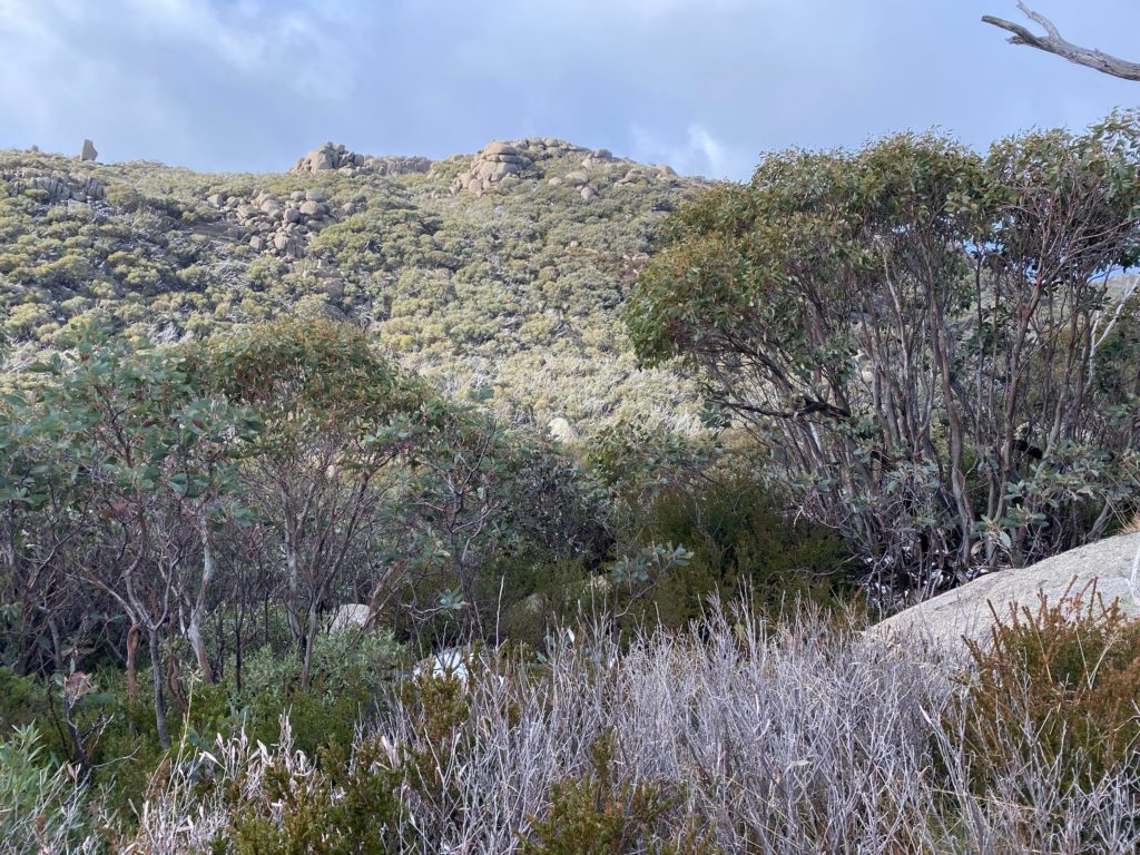
The track was quite steep with lots of steps.
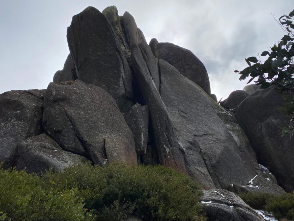
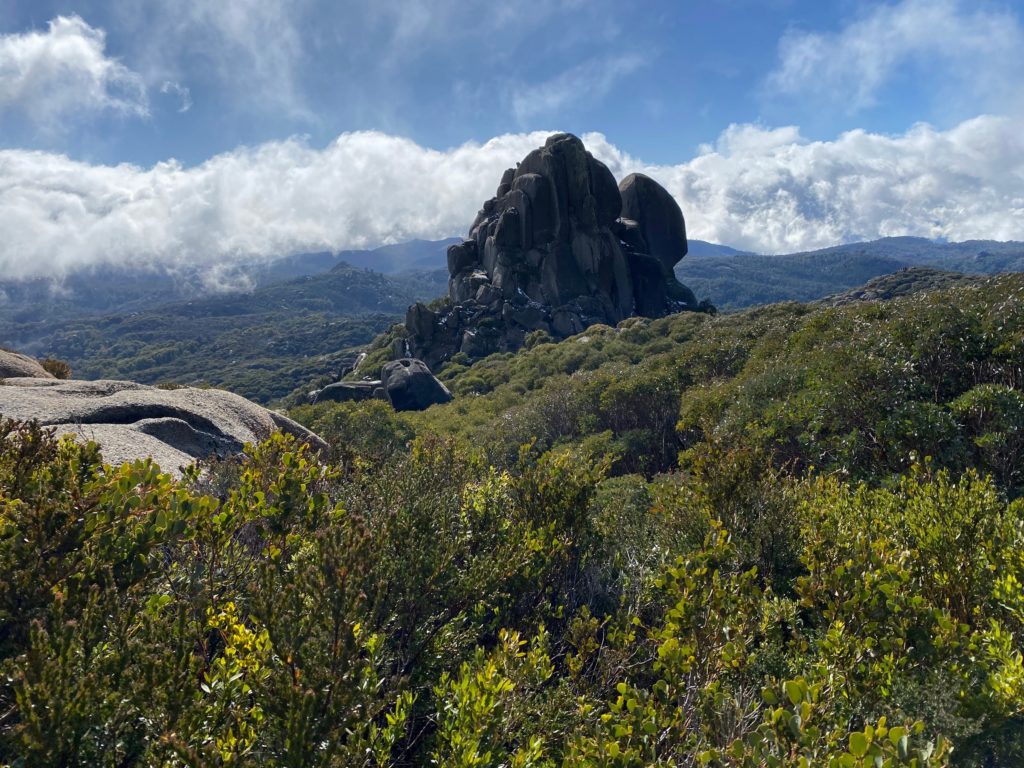
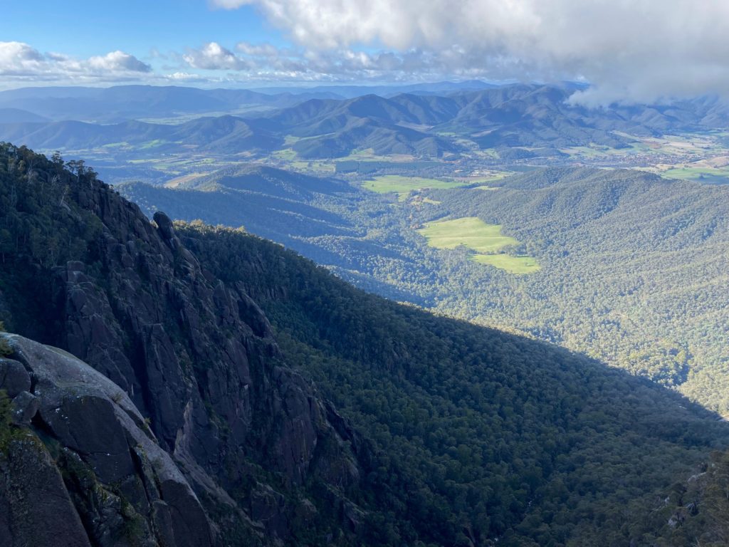
Soon we reached the Cathedral – an impressive rock tor.
The CathedralThe Cathedral from south
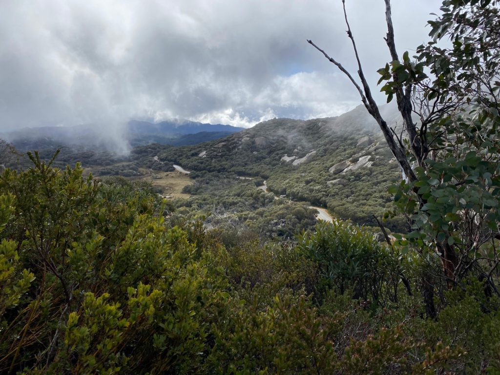
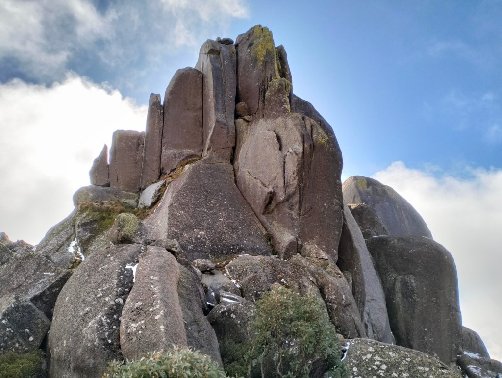
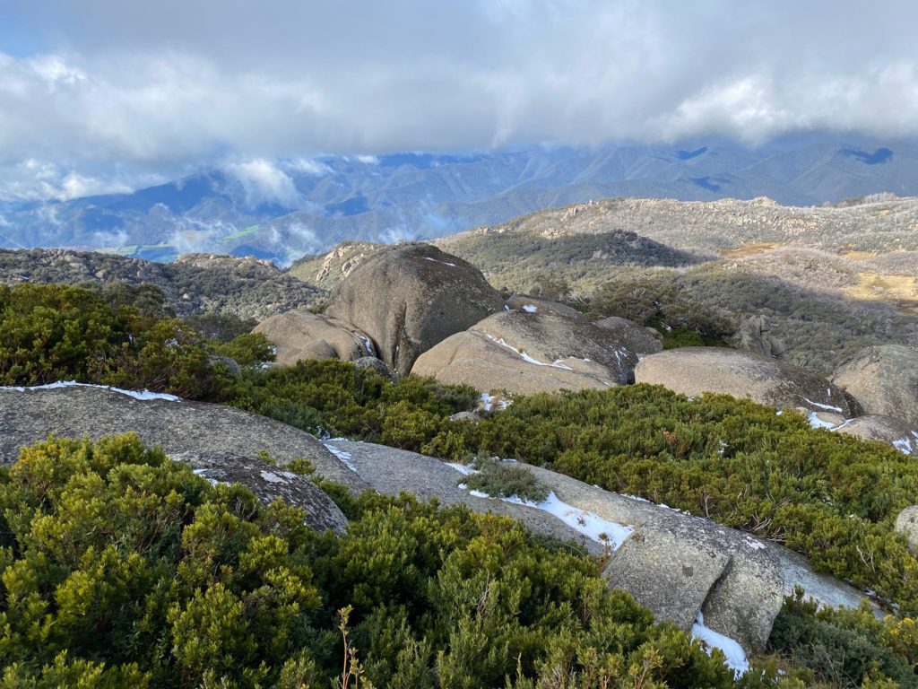
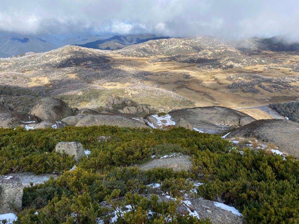
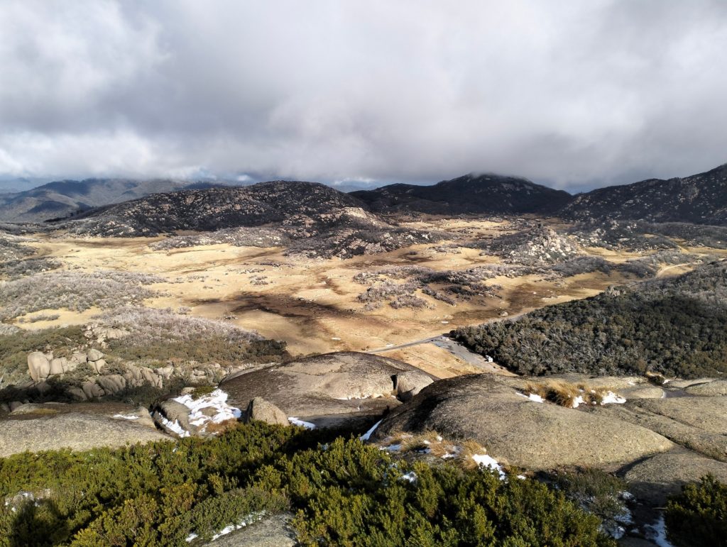
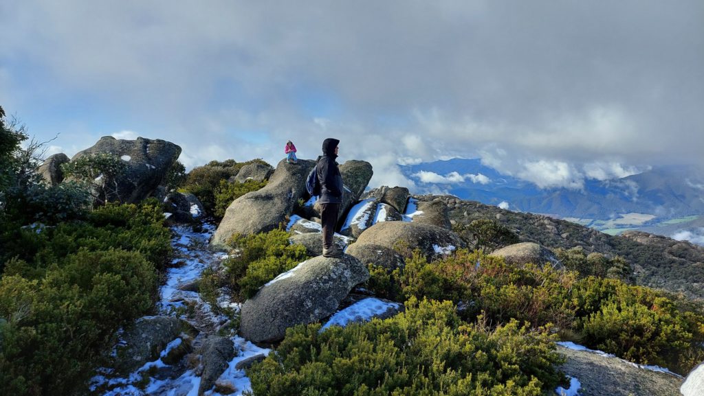
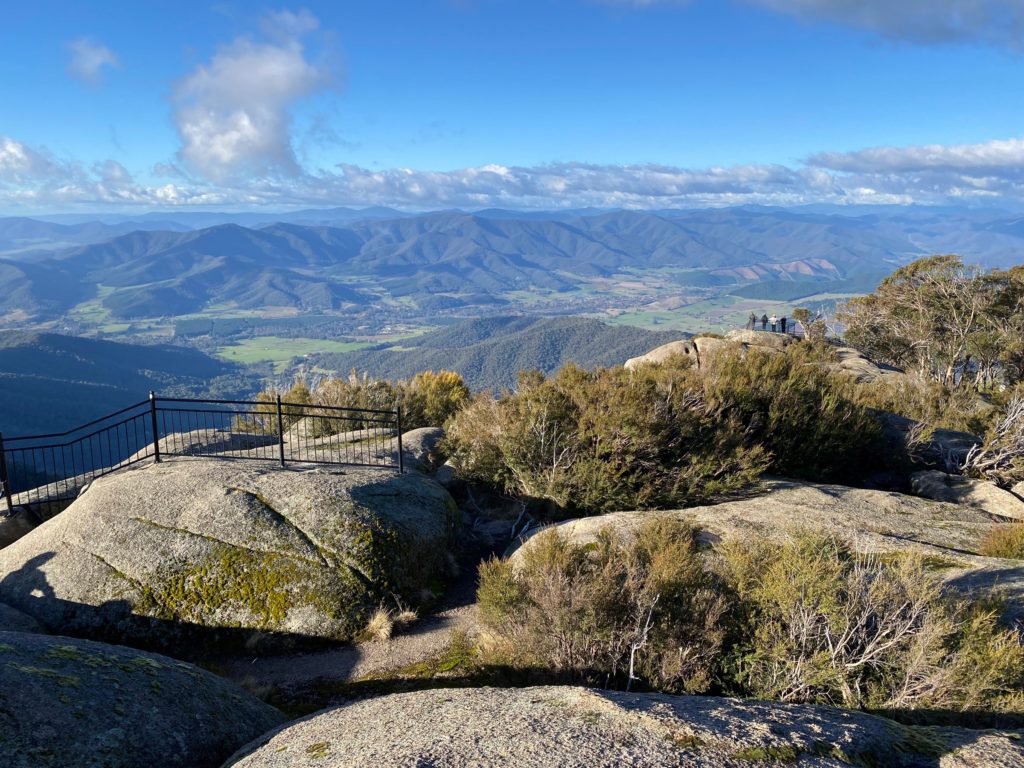
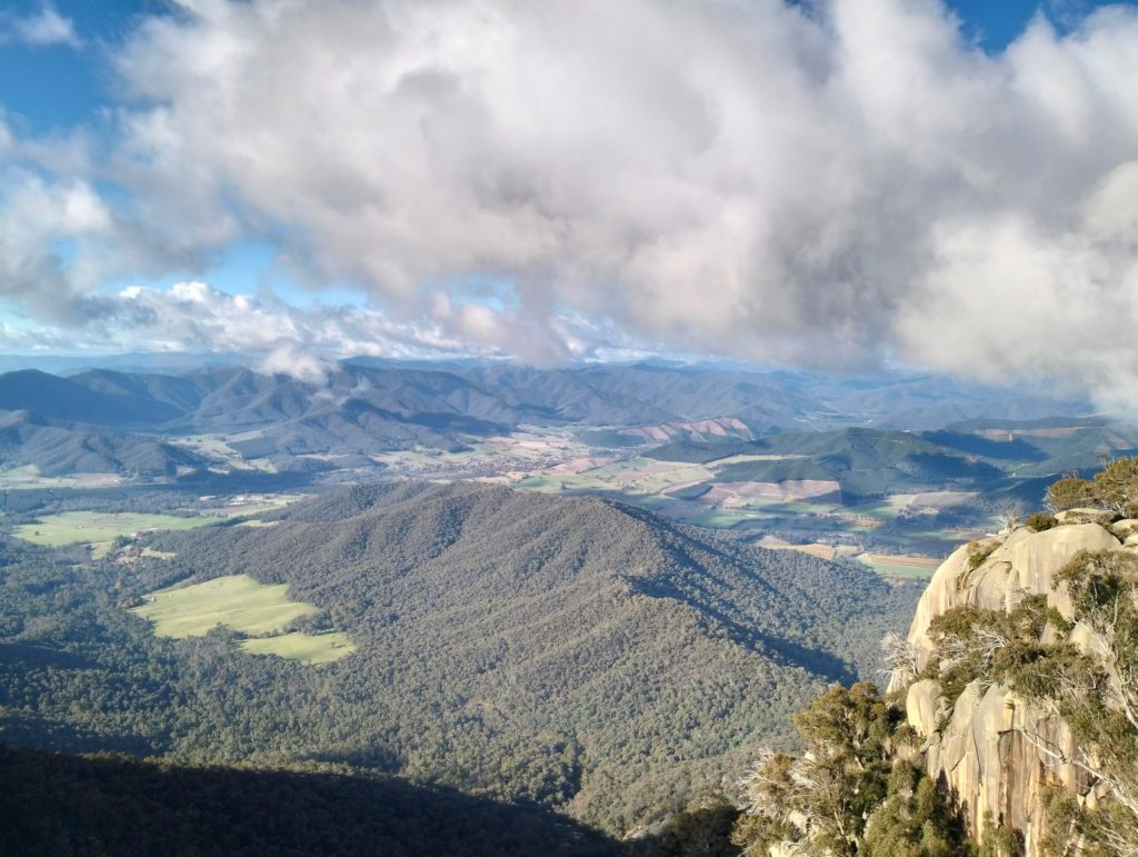
After about 400 meters we were on the Hump – 1695 meters above sea level.
The views were breath-taking.
The land below looked like another planet.
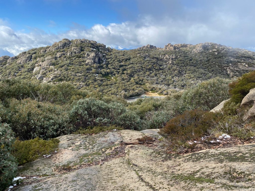
The Cathedral from the Hump
It was definitely worth it to climb up here.
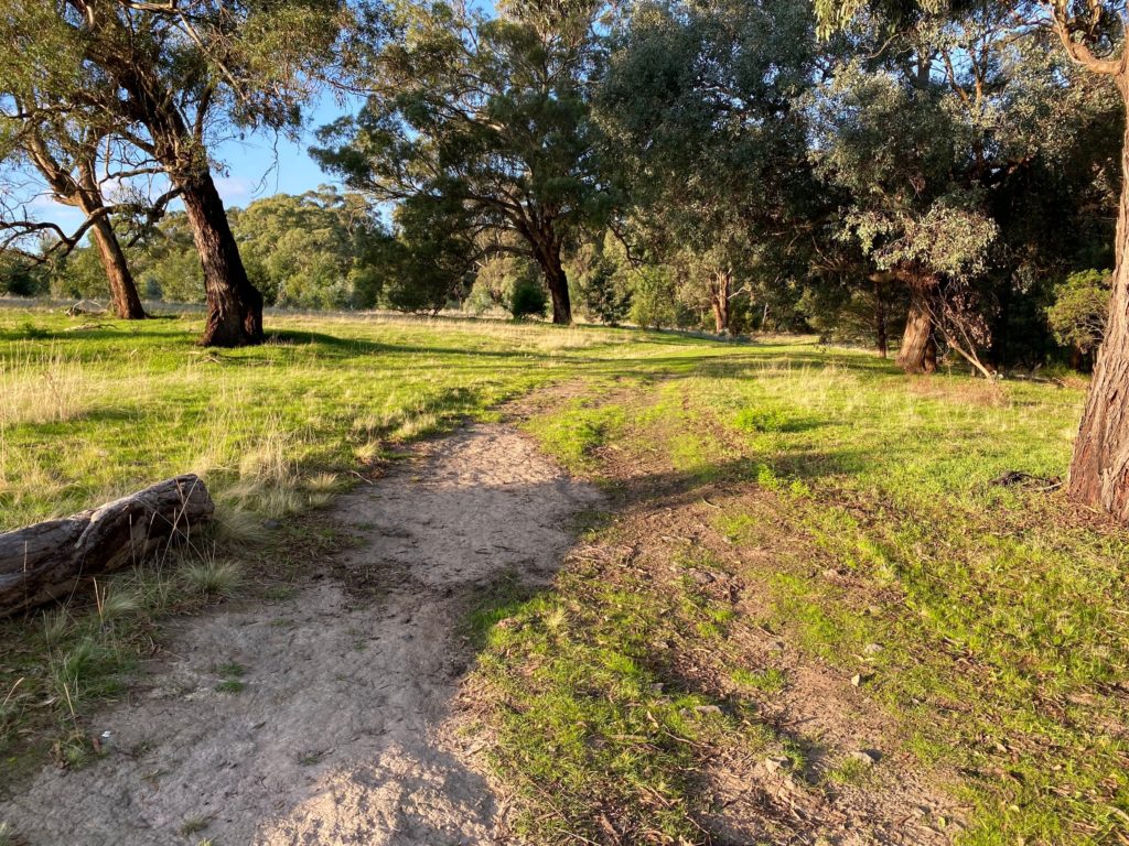
Our descent was much faster. It took us about 1 hour to complete the walk.
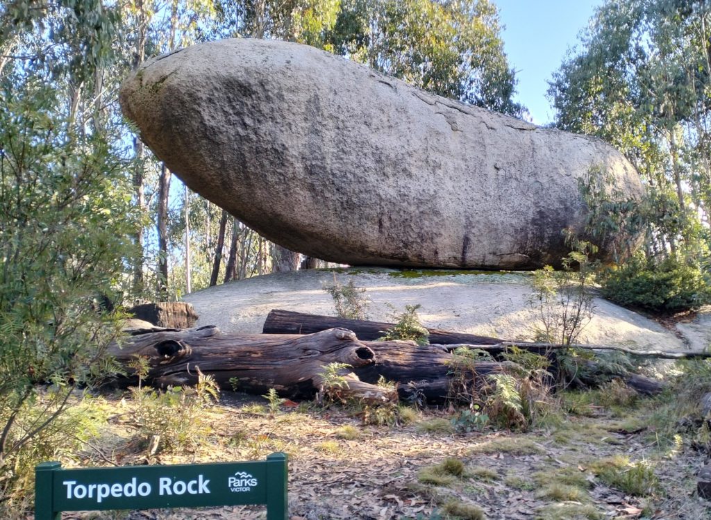
After having a lunch we drove down to the Torpedo Rock:
Torpedo Rock
After that we drove to the Mount Buffalo Chalet to enjoy fabulous views from the Bents Lookout and the Echo Point.
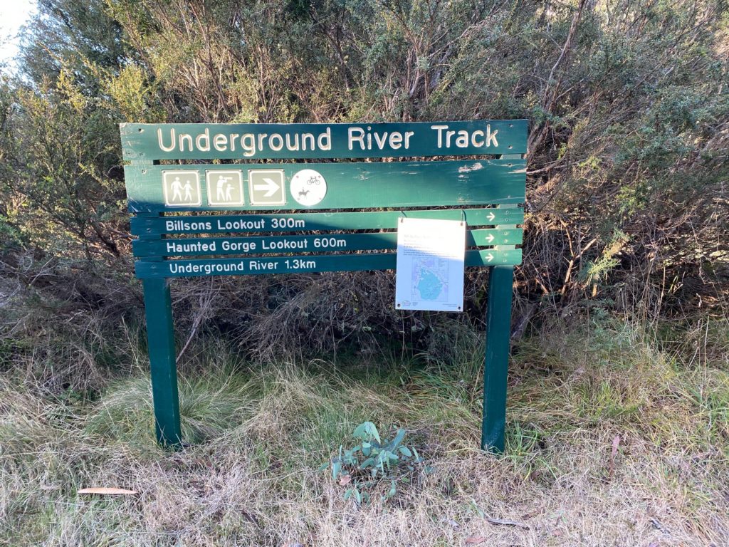
We finished our trip with a walk to the Underground River – 2.6 km return.
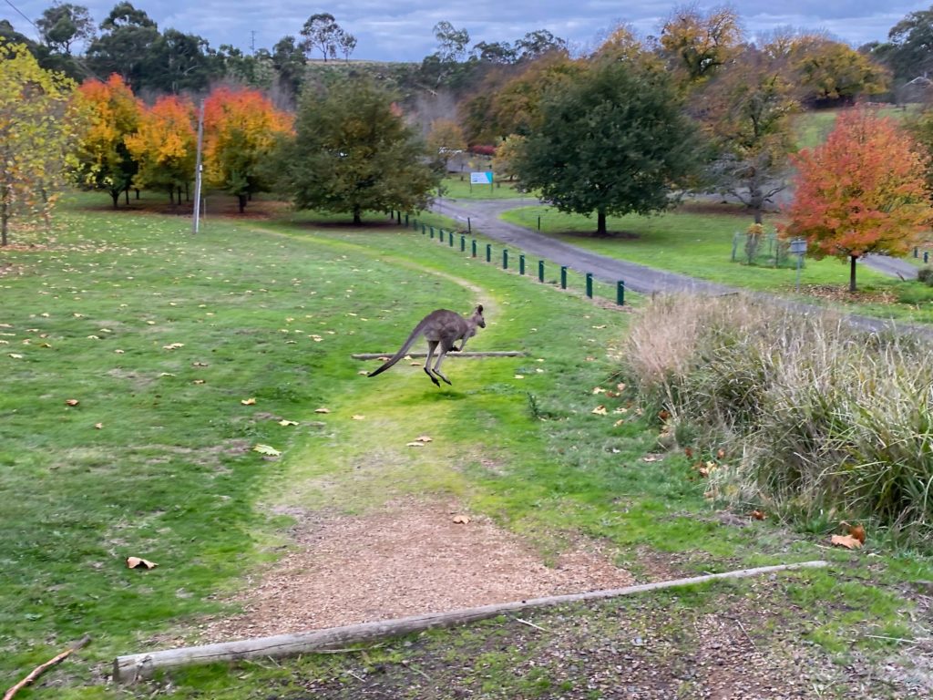
Situated at the southernmost point of the Australian mainland, Wilsons Prom is home to breathtaking views, ragged cliffs, and some of the most adorable Australian wildlife around.
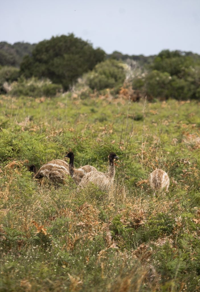
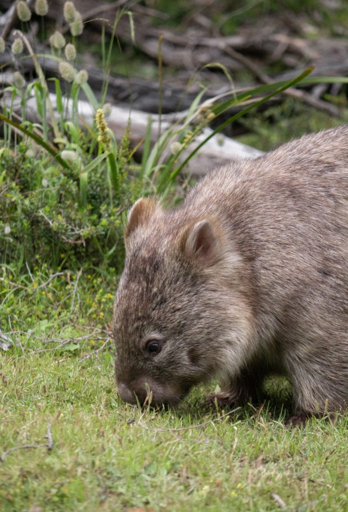
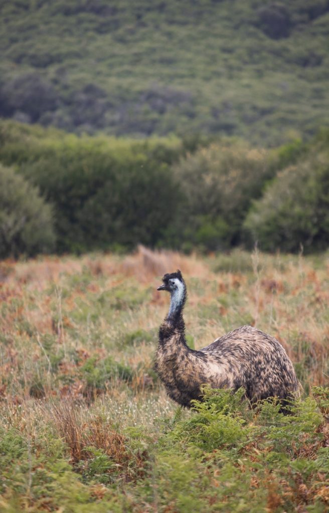
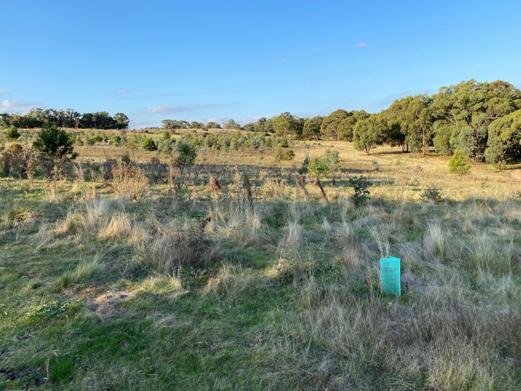
All throughout the national park, wombats, emus, and kangaroos abound. During our visit, we were especially excited to encounter an emu out and about in the wild! Local advice suggested that the best way to do this was to try the Prom Wildlife Walk.
Finding the Walk
The Prom Wildlife Walk is located towards the entrance of the park. As you drive towards the main campground, Tidal River, keep your eyes peeled for the ‘Wildlife Viewing Area’. It looks like a large grassy field and has plenty of car parking spaces. You will need to stop here and wander through the field to access the trailhead.
Before you begin your walk, park facing towards the field and spend some time sitting in your car admiring the landscape. Animals will often venture out into the viewing area when it’s quiet. This spot makes for some great snaps, as you don’t need to dodge around any shrubs while taking your photo.
Exploring The Prom Wildlife Walk Trail
The trail itself is short and sweet. It’s a 2.3km flat loop and only takes around 45 minutes to complete. Surprisingly, it’s a Grade 2 trail. We personally felt like this was a slight overestimate. It was a very simple and flat walk.
You can tell that the wildlife walk trail has been carefully laid out with its main purpose in mind, and there are plenty of spots that accommodate stopping to snap some photos of the wildlife or times where you want to step off of the trail for a closer look. With a comfortable and wide design, we didn’t feel pressured to race around the loop. There was plenty of room for other hikers to pass by as we took it at our own pace.
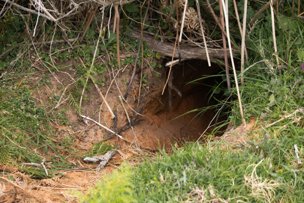
Do be mindful, however, that the path is dirt and can be quite rough after heavy bouts of rain. Many wombats have built their burrows just off of the path, so keep your eyes out for gouges in the middle of the trail and watch for holes when leaving the track.
You will also find plenty of animal poo along the trail. Wandering along and identifying who exactly made it is a strangely fun way to fill time while you wait for the wildlife to make their presence known.
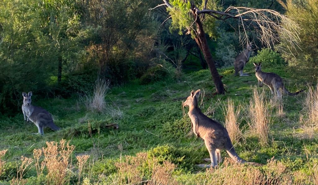
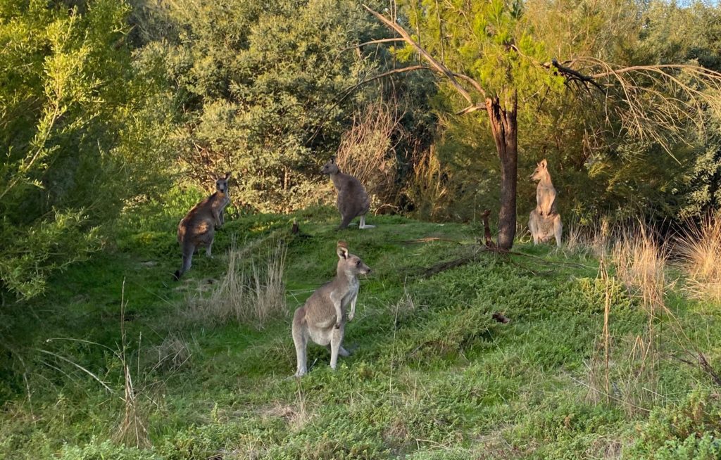
After the first few signs of life – burrows, gouges, a rainbow of poop – we spotted our first native animals very quickly! The local kangaroos and wombats were everywhere, even in the middle of the day.
The most special moment, however, was our magical emu encounter. We were lucky enough to stumble across an emu family. The chicks were very calm and used to people, even at such a young age. Still, we kept to a reasonable distance so as to not bother them.
Final Thoughts: Is The Prom Wildlife Walk Worth Stopping For?
The Prom Wildlife Walk is probably the simplest hike that Wilsons Prom has to offer. Its landscapes can’t really compare to treks like the Mount Bishop walk or the Sealers Cove walk, but its animal encounters can’t be beaten. If you’re looking for your own personal Australian animal experience in the wild, then the Prom Wildlife Walk is a must-do!
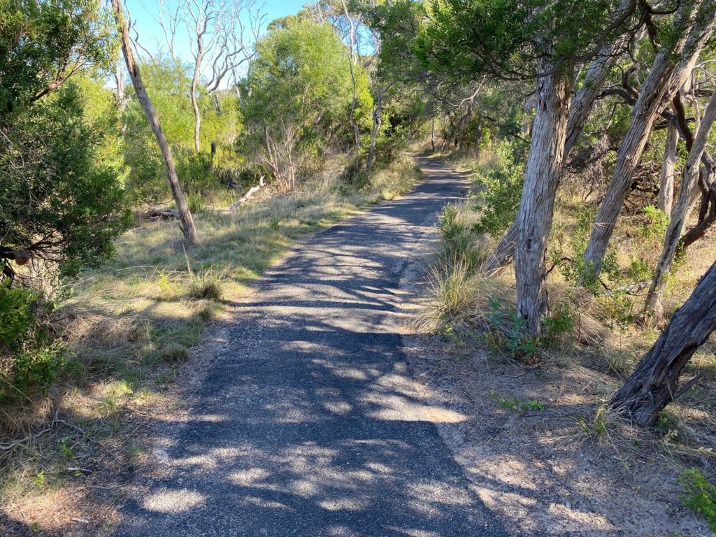
I recently visited Tower Hill Nature reserve to explore the unique geological formations, hopefully spot some wildlife and make claim to the fact I had bushwalked in a dormant volcano! Myself and some friends picked the Wagon Bay Loop which didn’t disappoint. The entire reserve sits in a volcanic crater, making it a fascinating area, regardless of what hiking route you choose to complete!
The Wagon Bay Loop is a 1.5-kilometre trail that takes you on a journey around the tranquil waters of Wagon Bay pond. The trail is graded as easy difficulty and takes approximately half an hour to complete. The loop is well signposted, and there are informative signs along the way that provide details about the flora and fauna that call the reserve home.
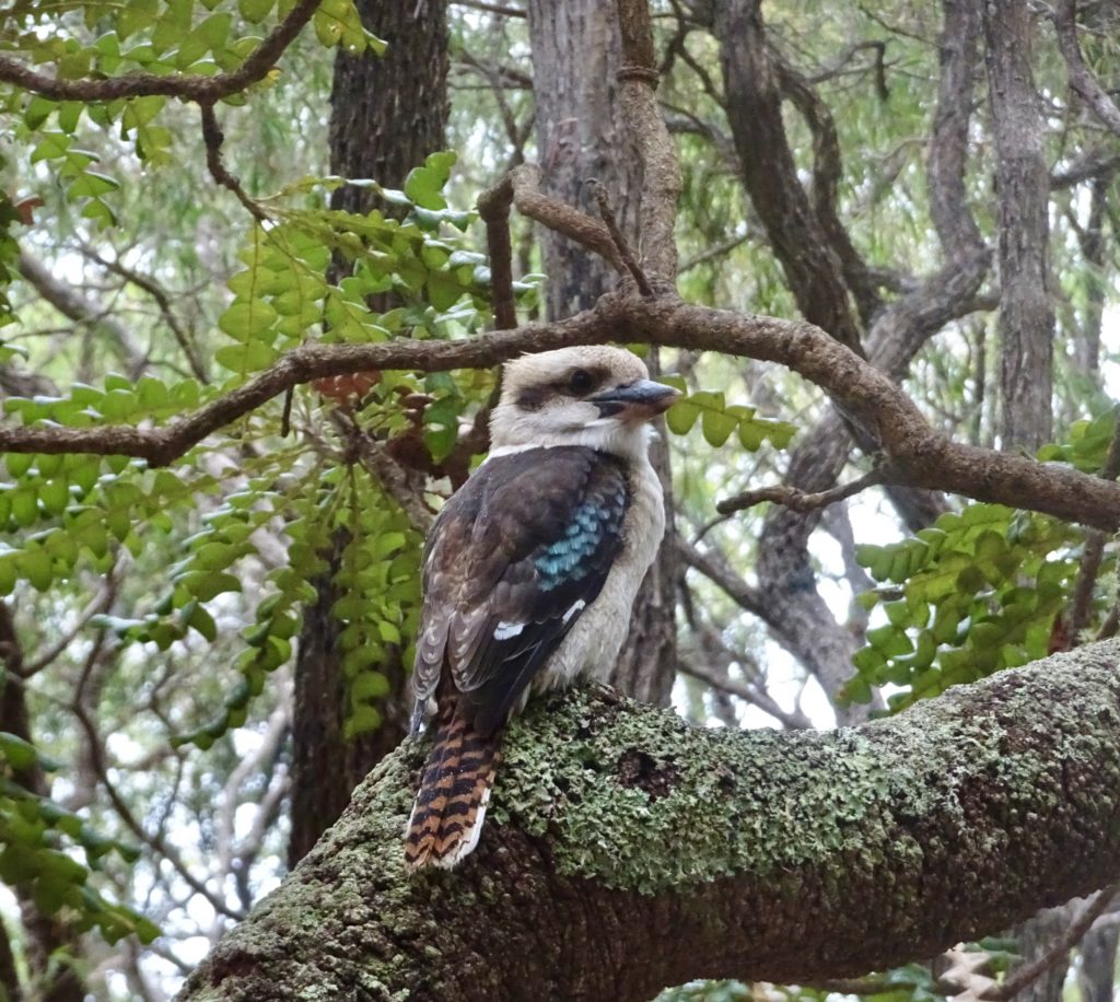
Kookaburra
As soon as I stepped onto the trail, I was greeted by beautiful views on the surrounding wetlands. It had recently rained which made the landscape lush and the air sweet; perfect bushwalking conditions. Black Swans, ducks and spoonbills were visible on the pond throughout, hiding in reeds and skimming across the water.
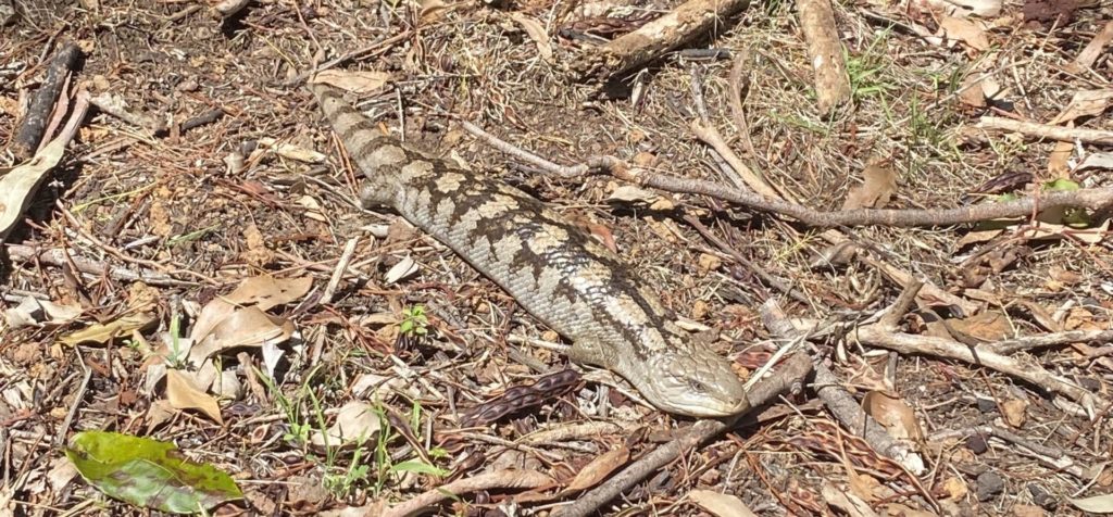
As I continued along the trail, I was amazed by the variety of vegetation and the diversity of wildlife that surrounded me. As always when bushwalking, I kept a lookout for the local snake population. Tower Hill Wildlife Reserve is home to several species of snakes, one of which I was lucky enough to spot (at a safe distance) curled up on the grass verge. Spotting a beautiful copperhead snake was a first for me, it slithered away before I was able to snap a photo! I did however, get a photo of a cute blue-tongued skink which was basking in the sun on the path in front of me!
Blue-tongued Skink
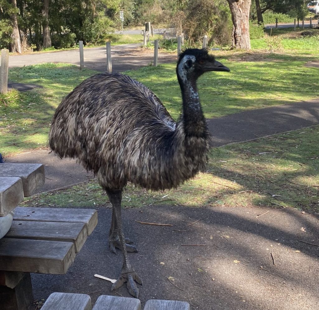
I completed the loop in just over half an hour, then headed to the picnic area by the Visitors Centre for a picnic lunch. On our way to the picnic area, we caught a glimpse of feathers and a flash of blue… before I knew it we were face-to-face with a pair of emus!
Emu
The big, beautiful birds walked rather prehistorically around the picnic area, likely trying their luck at a snack! There are many signs in the area warning visitors against feeding the birds – I wouldn’t help but assume the birds were regulars at the picnic spot!
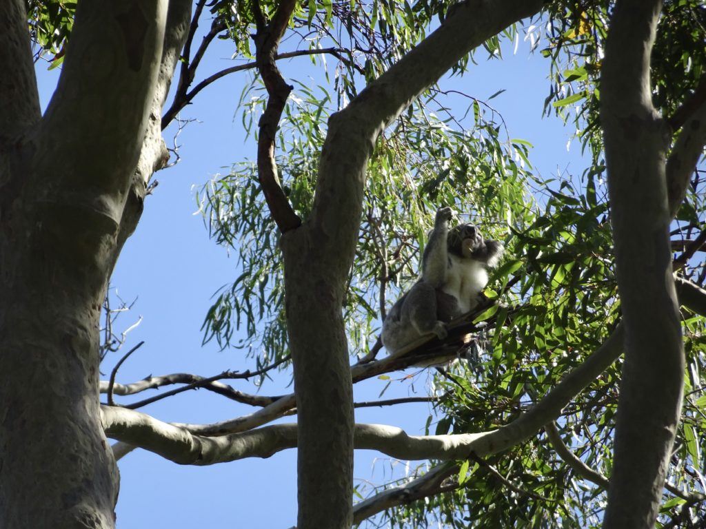
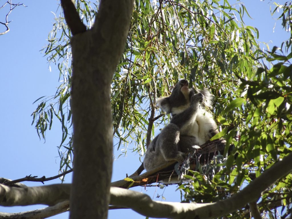
Even though we had finished the trail, we were still in store for another surprise… we were lucky enough to spot a koala high in a eucalyptus tree, munching on some leaves. It was an incredible experience to witness not only a wild koala (which never gets old) but one that was awake!
Koalas sleep for around 20 hours a day, so we were really stoked to have this experience.
The Tower Hill Nature Reserve completely surpassed my expectations, the bush walk we chose was on the easier side but still so rewarding with great views and wildlife encounters. A visit to the reserve is a must-do for anyone looking for something a little different and a lot interesting!
We decided to go to Point Nepean National Park, even though it is almost a 2-hour drive from our home. We were lucky with the weather – it was sunny and warm.
By the time we arrived, it was already lunchtime. So, we started by having lunch next to the Gunner’s Cottage. The cottage itself was closed. There was a toilet nearby, but no drinking water, even though we saw a sign saying that it’s available here.
We started on the Walter Pisterman Track.
The sign reads:
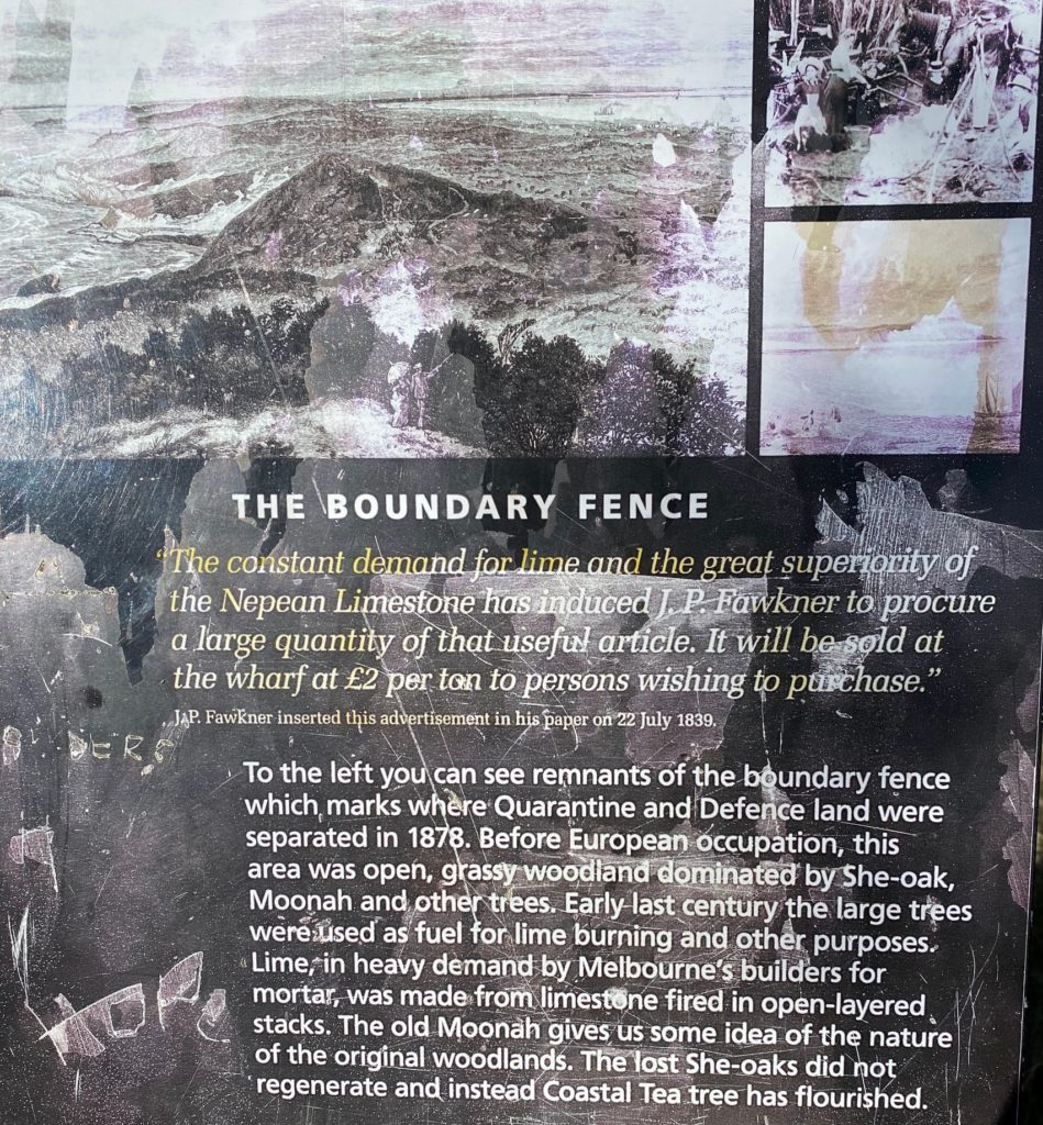
The Boundary Fence The constant demand for lime and the great superiority of the Nepean Limestone has induced J. P. Fawkner to procure a large quantity of that useful article. It will be sold at the wharf at £2 per ton to persons wishing to purchase.” JAP. Fawkner inserted this advertisement in his paper on 22 July 1839.
To the left you can see remnants of the boundary fence which marks where Quarantine and Defence land were separated in 1878. Before European occupation, this area was open, grassy woodland dominated by She-oak, Moonah and other trees. Early last century the large trees were used as fuel for lime burning and other purposes. Lime, in heavy demand by Melbourne’s builders for mortar, was made from limestone fired in open-layered stacks. The old Moonah gives us some idea of the nature of the original woodlands. The lost She-oaks did not regenerate and instead Coastal Tea tree has flourished.
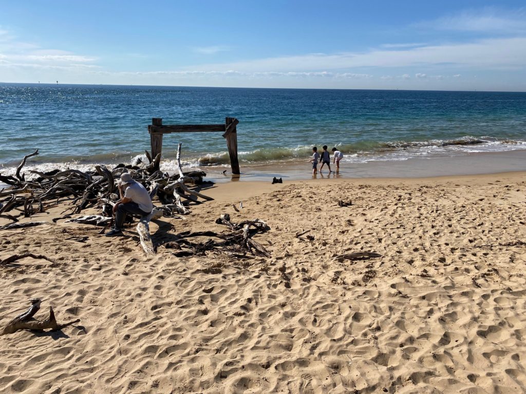
We walked past the cemetery and reached the remains of the Cattle Quarantine Jetty.
This is all that remains from the Cattle Quarantine Jetty
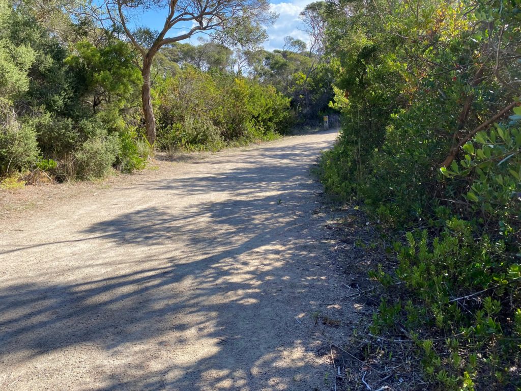
We walked on the Coles Track then.
Coles Track
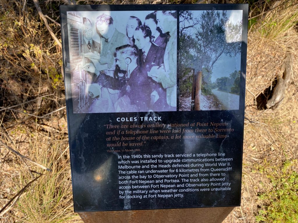
The sign reads:
COLES TRACK “There are always artillery stationed at Point Nepean and if a telephone line were laid from there to Sorrento at the house of the captain, a lot more valuable time would be saved.” The Argus, 13 March 1905.
In the 1940s this sandy track serviced a telephone line which was installed to upgrade communications between Melbourne and the Heads defences during World War II. The cable ran underwater for 6 kilometres from Queenscliff across the bay to Observatory Point and from there to both Fort Nepean and Portsea. The track also allowed access between Fort Nepean and Observatory Point jetty by the military when weather conditions were unsuitable for docking at Fort Nepean jetty.
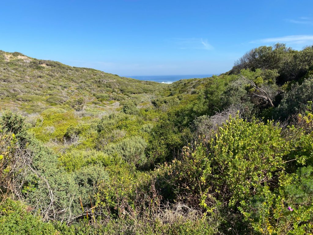
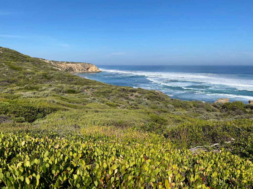
We visited a lookout overlooking the Cheviot Beach where Australian prime minister disappeared.
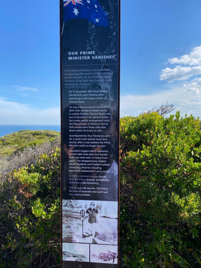
OUR PRIME MINISTER VANISHES “Low cloud and heavy rain have been hampering the search for the missing prime minister. So far there has been no trace of Mr Holt who has now been missing for 22 hours.”
On 17 December 1967 Prime Minster Harold Holt went missing after swimming in the waters below at Cheviot Beach.
He was a keen swimmer and snorkel diver who owned a holiday house in nearby Portsea. Cheviot Beach was out of bounds to the general public but under special arrangement with the Department of Defence Harold Holt would swim these chilly Bass Strait waters he knew so well.
Accompanied by four friends he went for a quick swim before lunch and shortly after it was realised the Prime Minister could no longer be seen.
Australia’s biggest search operation to that date took place but Harold Holt was never seen or heard from again. The disappearance created world headlines and fuelled multiple conspiracy theories including abduction, assassination and suicide.
In 2005 a coronial inquest found that the Prime Minister accidentally drowned while swimming.
The 59 year old was the 17th Prime Minister of Australia and spent just two years as leader.
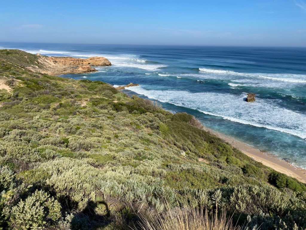
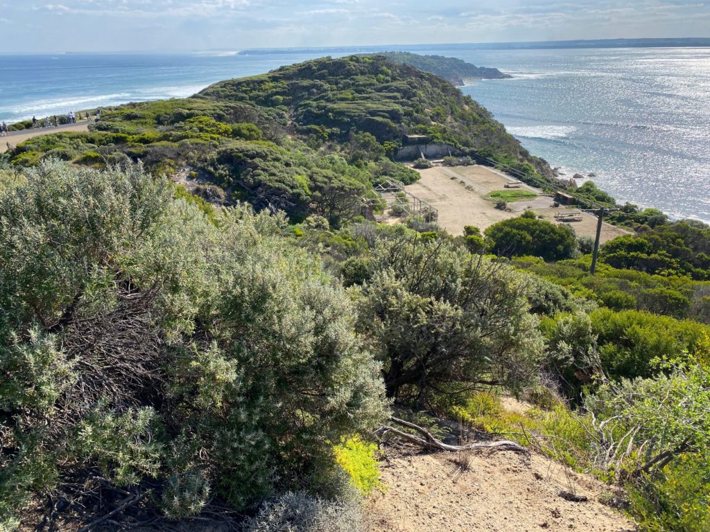
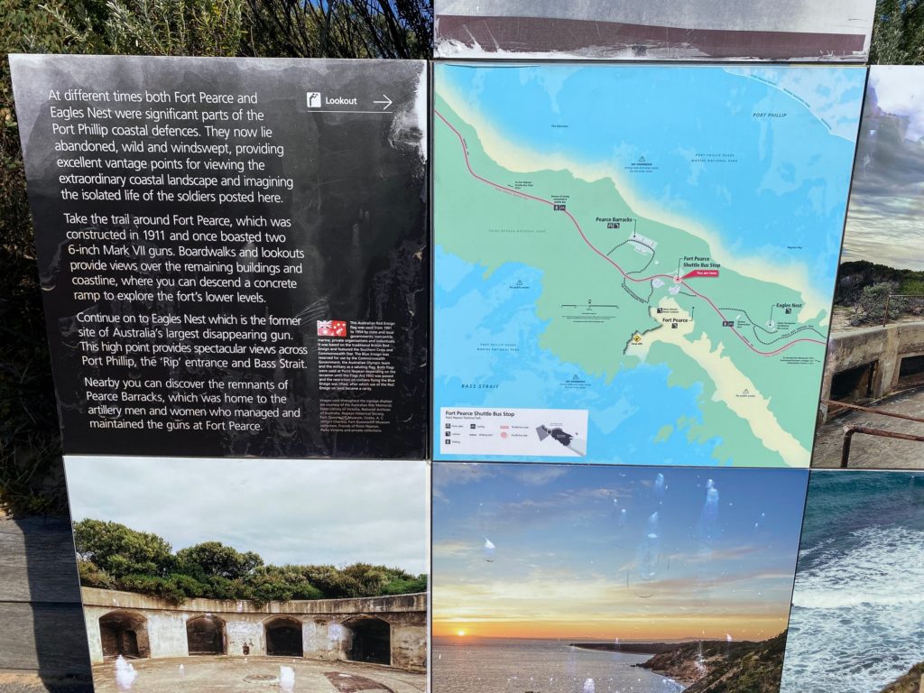
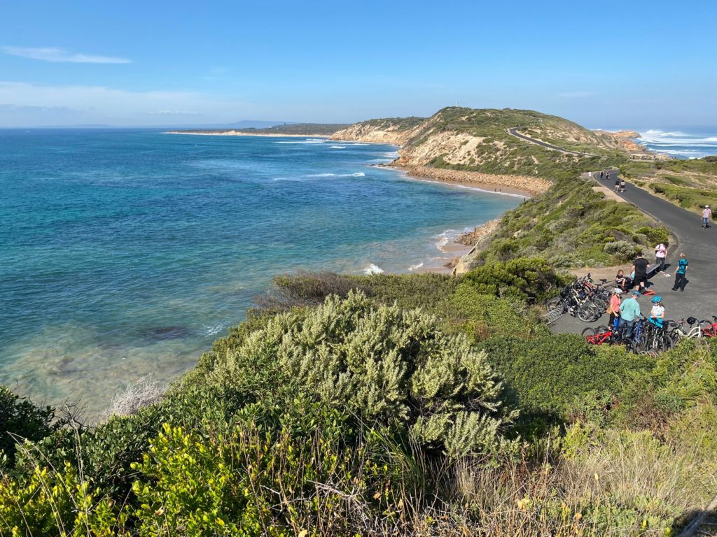
Great ocean and bay views from Fort Pearce.
The sign reads:
At different times both Fort Pearce and Eagles Nest were significant parts of the Port Phillip coastal defences. They now lie abandoned, wild and windswept, providing excellent vantage points for viewing the extraordinary coastal landscape and imagining the isolated life of the soldiers posted here.
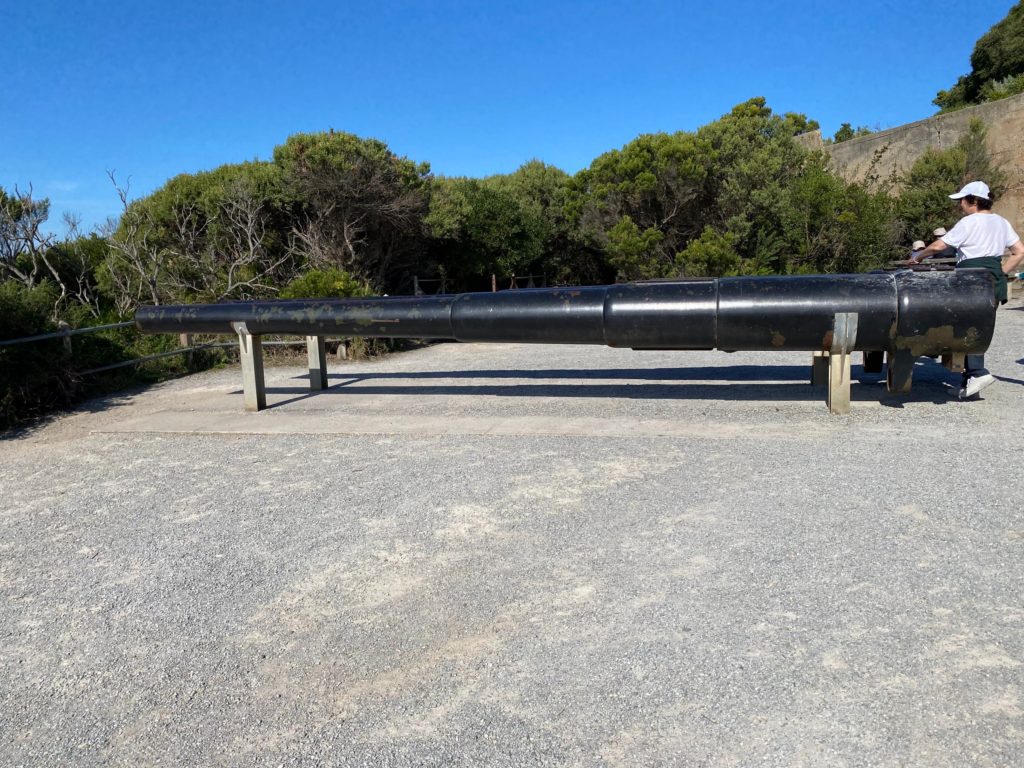
Take the trail around Fort Pearce, which was constructed in 1911 and once boasted two 6-inch Mark VII guns. Boardwalks and lookouts provide views over the remaining buildings and coastline, where you can descend a concrete ramp to explore the fort’s lower levels.
Continue on to Eagles Nest which is the former site of Australia’s largest disappearing gun. This high point provides spectacular views across Port Phillip, the ‘Rip’ entrance and Bass Strait.
Nearby you can discover the remnants of Pearce Barracks, which was home to the artillery men and women who managed and maintained the guns at Fort Pearce.
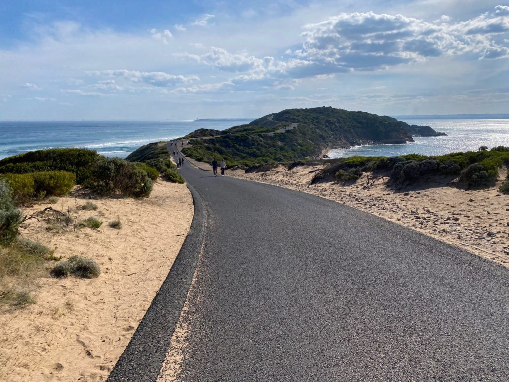
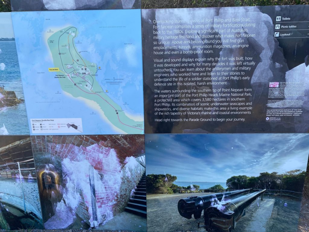
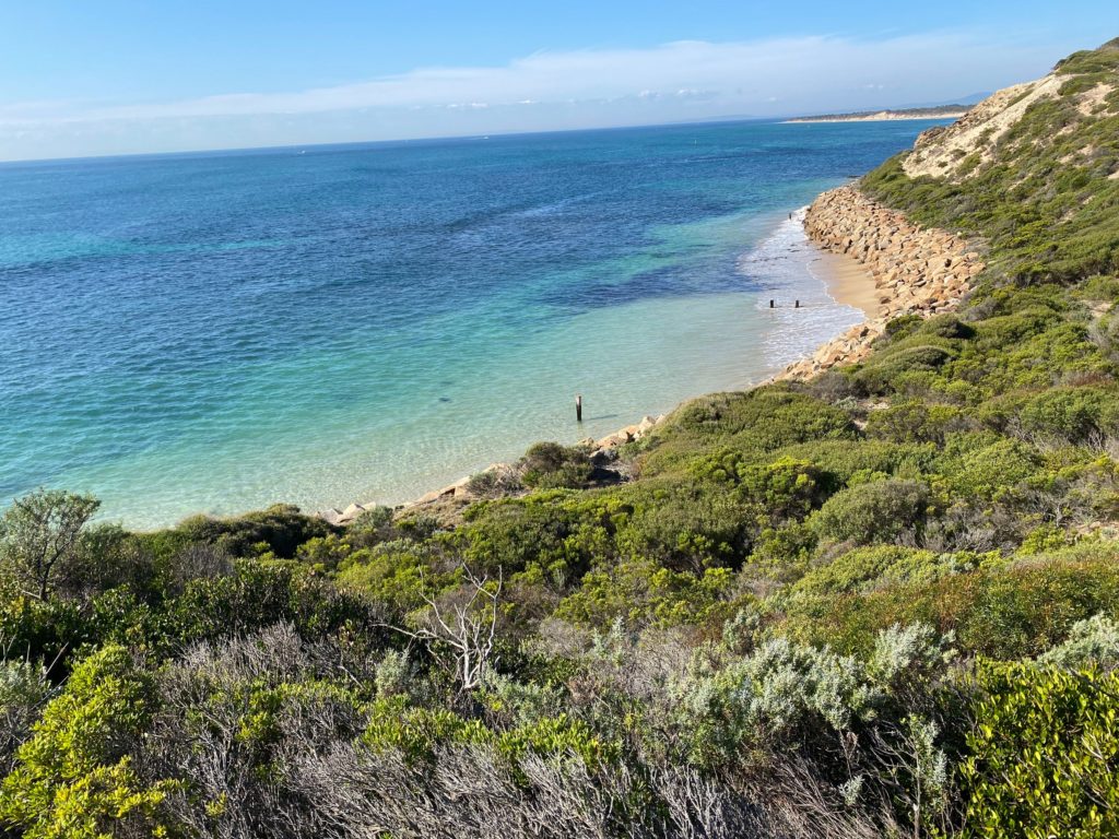
We reach Fort Nepean after walking for about 1 hour.
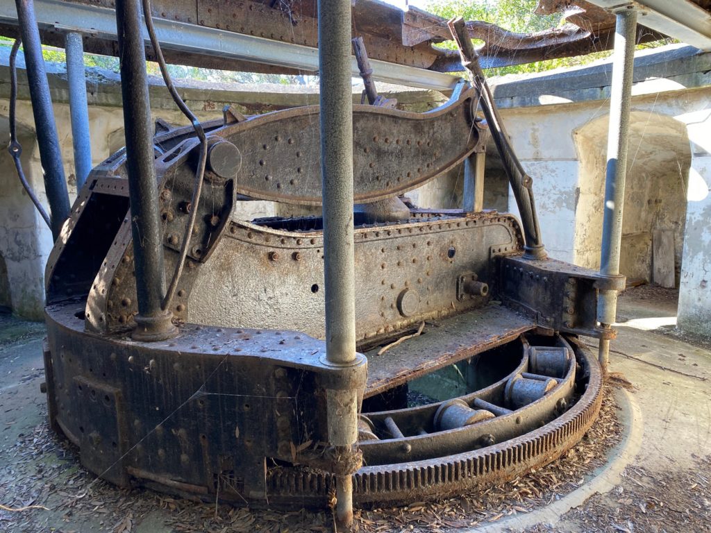
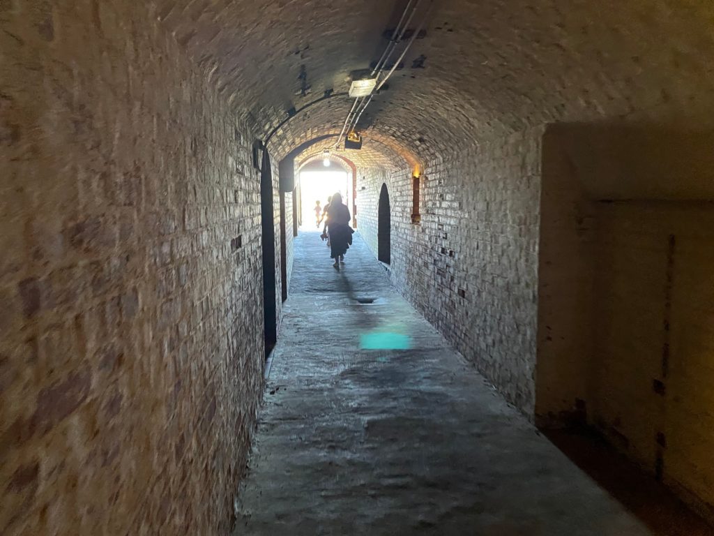
Overlooking stunning views of Port Phillip and Bass Strait, Fort Nepean comprises a series of military fortifications dating back to the 1880s. Explore a significant part of Australia’s military heritage first-hand and discover what makes Fort Nepean so unique. Above and below ground you will find gun emplacements, tunnels, ammunition magazines, an engine house and even a bomb-proof room.
Visual and sound displays explain why the fort was built, how it was developed and why for many decades it was left virtually untouched. You can learn about the artillerymen and military engineers who worked here and listen to their stories to understand the life of a soldier stationed at Port Phillip’s early defence site in this isolated, harsh environment.
The waters surrounding the southern tip of Point Nepean form an important part of the Port Phillip Heads Marine National Park, a protected area which covers 3,580 hectares in southern Port Phillip. Its combination of scenic underwater seascapes and shipwrecks, and diverse habitats make this area a living example of the rich tapestry of Victoria’s marine and coastal environments.
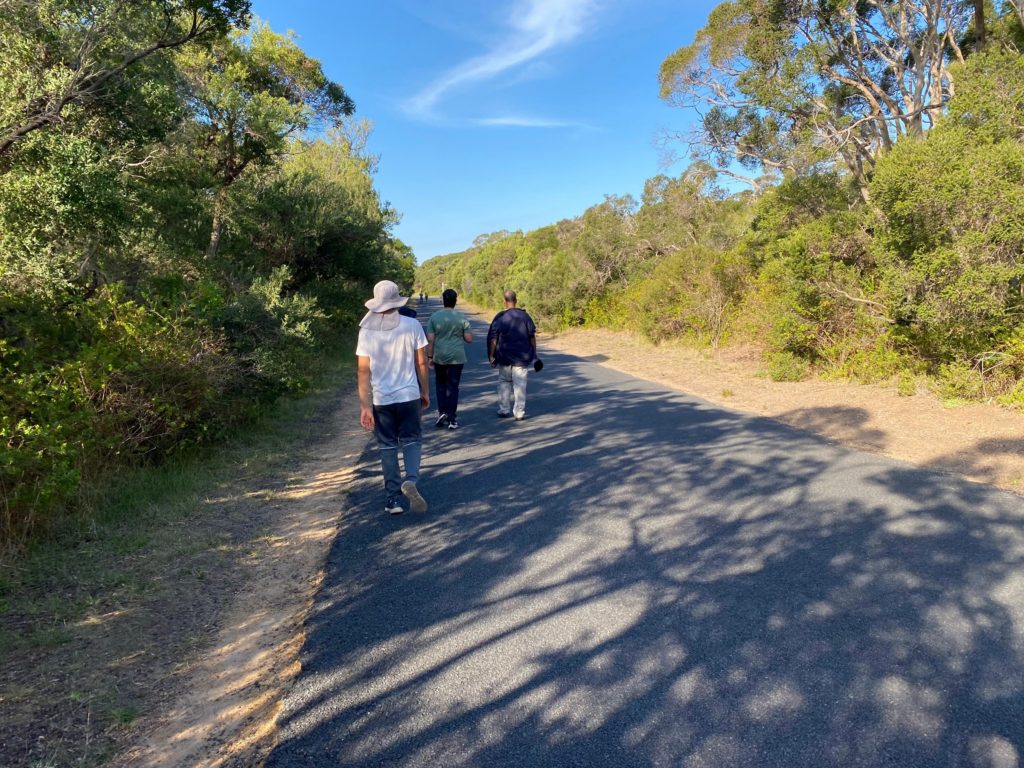
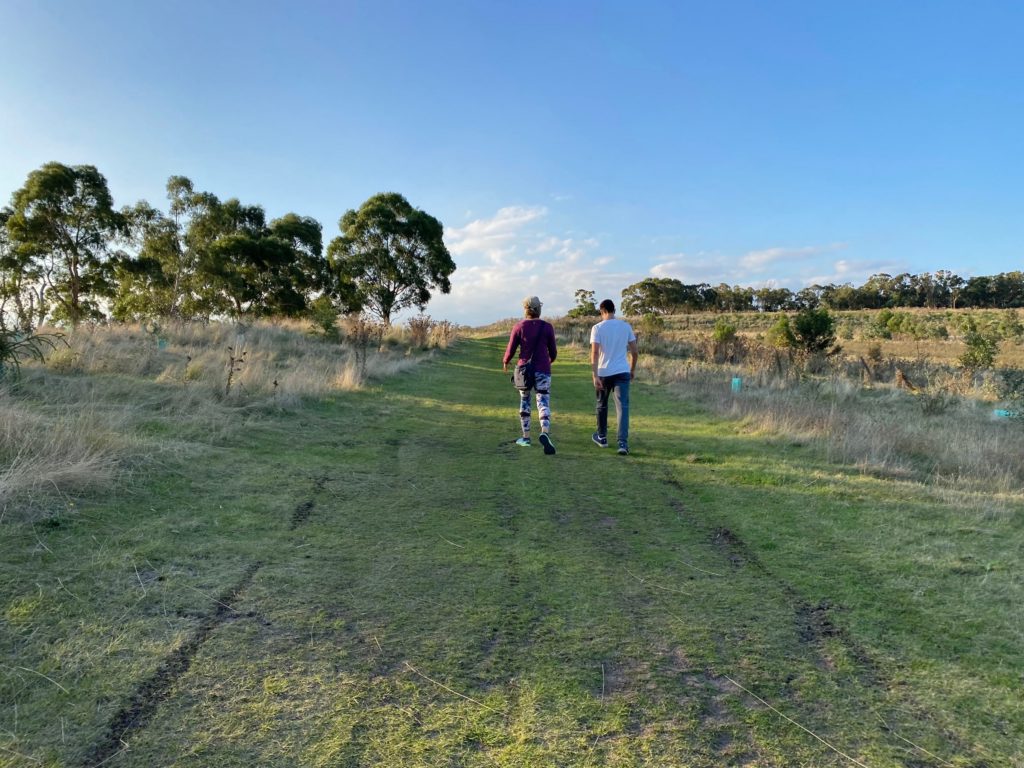
We decided to return on the road – it was closer and there were no cars except a shuttle bus.
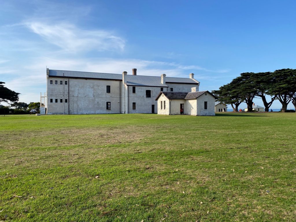
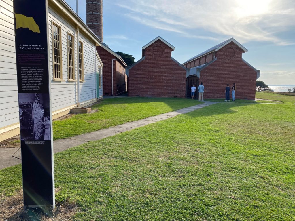
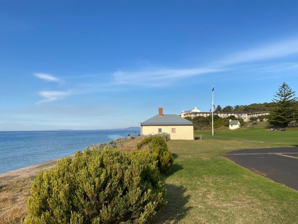
After returning to our car, we drove to the Quarantine Station and spent about an hour exploring the old buildings.
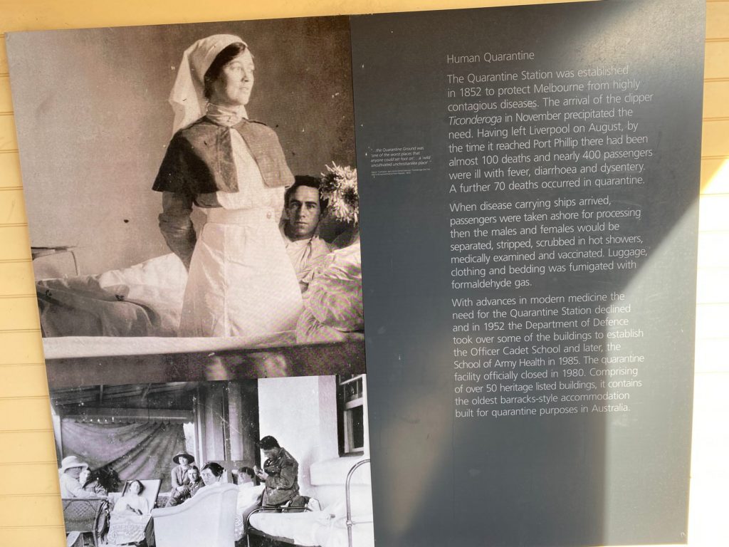
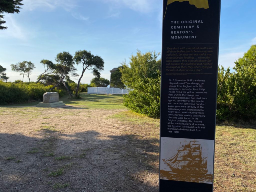
The sign reads:
Human Quarantine The Quarantine Station was established in 1852 to protect Melbourne from highly contagious diseases. The arrival of the clipper Ticonderoga in November precipitated the need. Having left Liverpool on August, by the time it reached Port Phillip there had been almost 100 deaths and nearly 400 passengers were ill with fever, diarrhoea and dysentery. A further 70 deaths occurred in quarantine.
When disease carrying ships arrived, passengers were taken ashore for processing then the males and females would be separated, stripped, scrubbed in hot showers, medically examined and vaccinated. Luggage, clothing and bedding was fumigated with formaldehyde gas.
With advances in modern medicine the need for the Quarantine Station declined and in 1952 the Department of Defence took over some of the buildings to establish the Officer Cadet School and later, the School of Army Health in 1985. The quarantine facility officially closed in 1980. Comprising of over 50 heritage listed buildings, it contains the oldest barracks-style accommodation built for quarantine purposes in Australia.
Overall, it was a great walk and a fascinating historical place.
It was cloudy and gloomy Easter Monday. It was raining from time to time but we decided to risk it and go to Mornington for a walk.
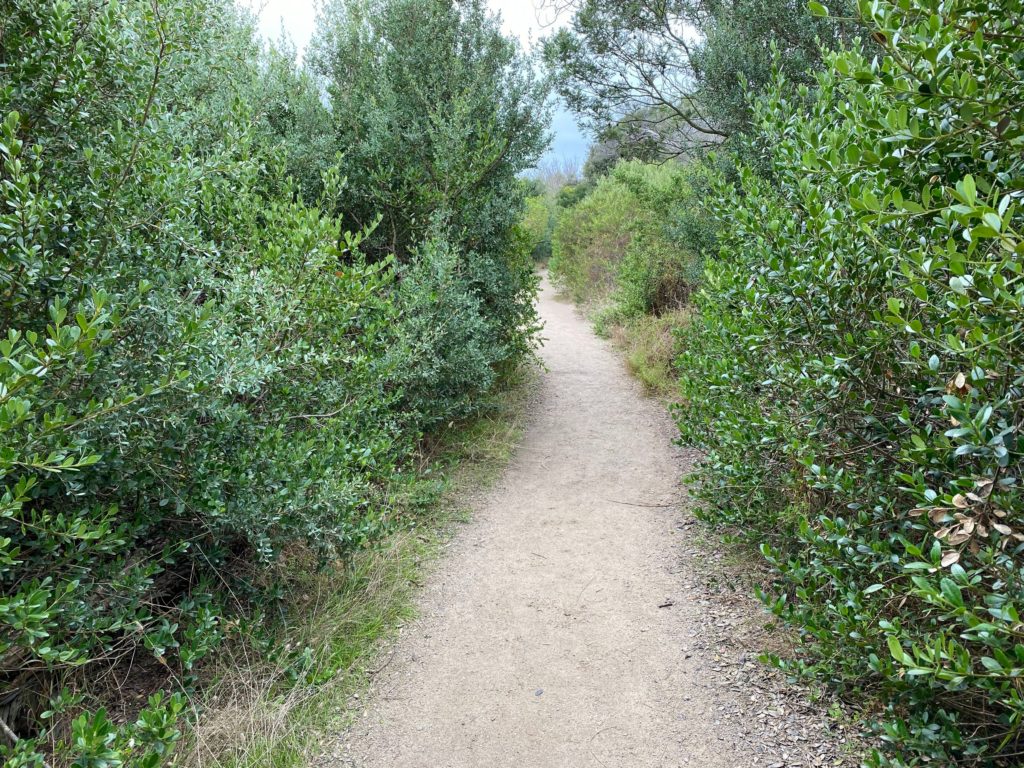
We started from the parking lot near the Dava Hotel.
The rain stopped. It was nice to walk and be sheltered from the wind by the thick bushes.
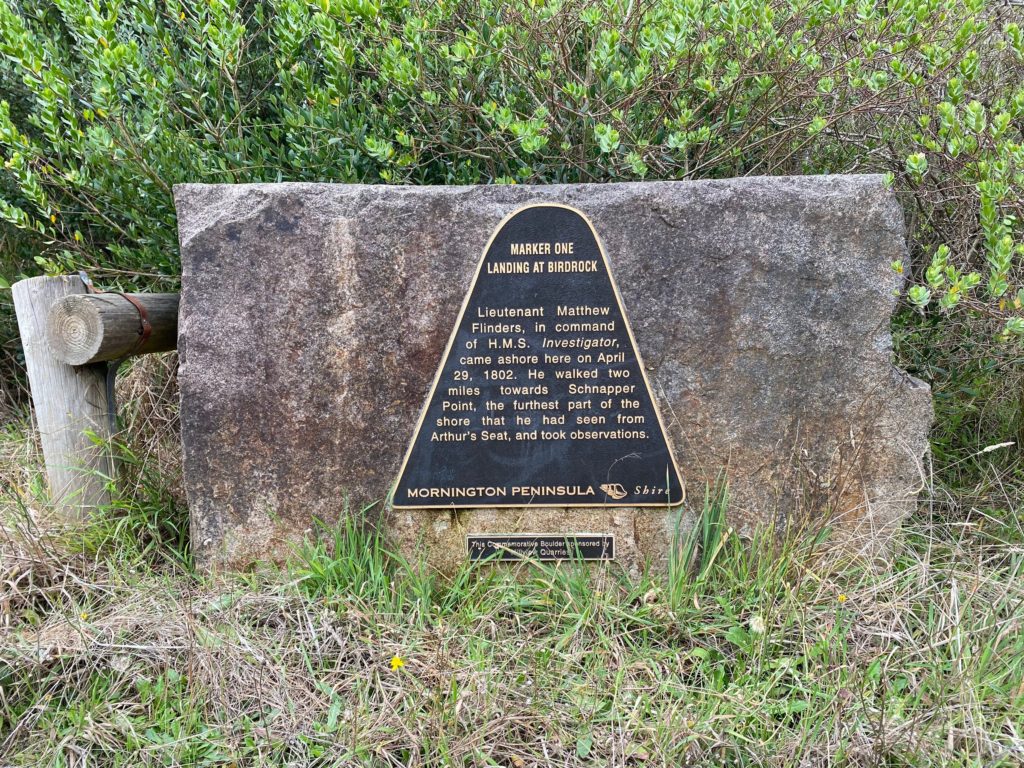
Commemorative Boulder
The plate reads:
MARKER ONE – LANDING AT BIRDROCK Lieutenant Matthew Flinders, in command of H.M.S. Investigator, came ashore here on April 29, 1802. He walked two miles towards Schnapper Point, the furthest part of the shore that he had seen from Arthur’s Seat, and took observations.
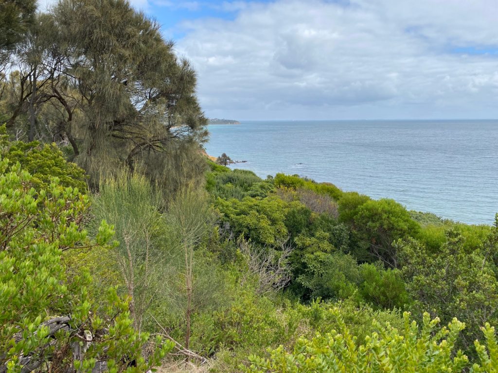
We enjoyed great clifftop views.
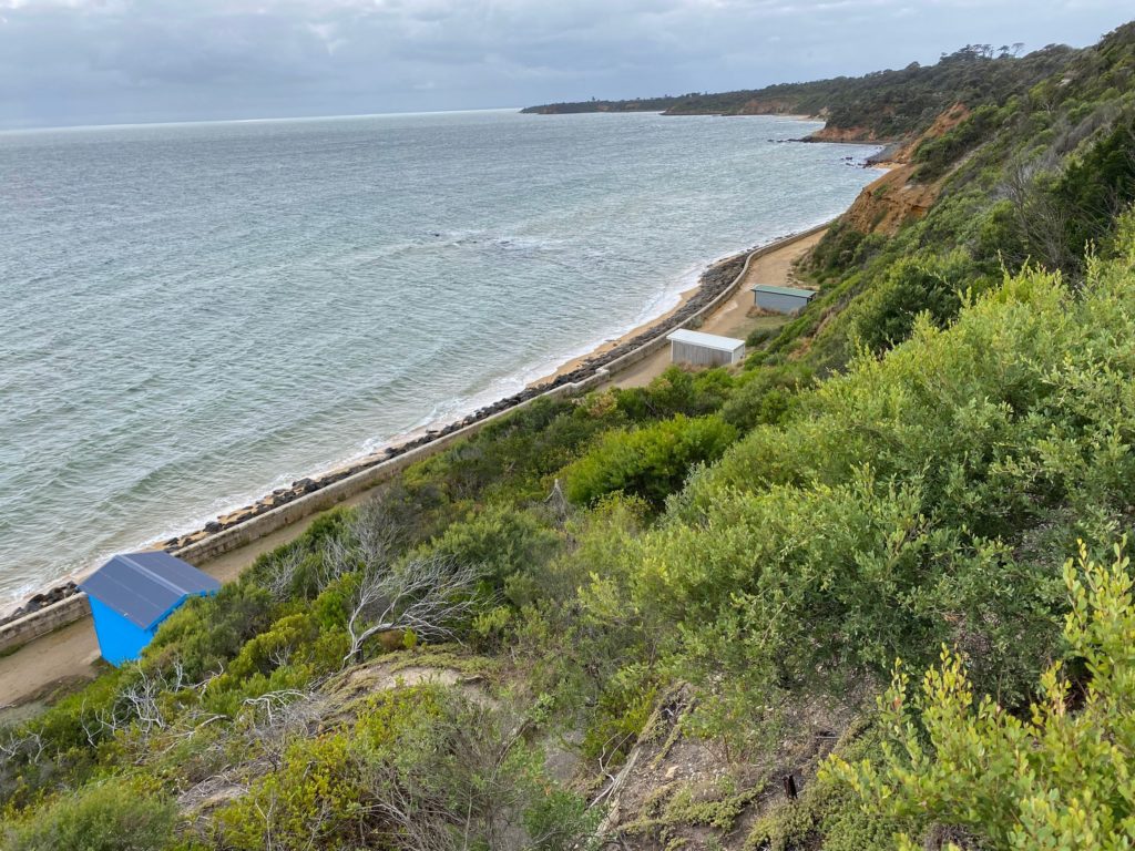
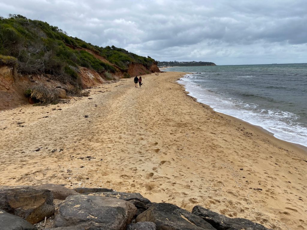
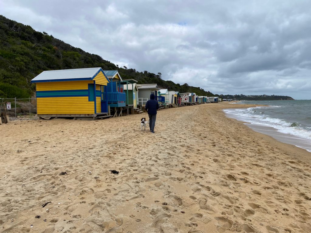
The trail ended after about 2 km. We walked on the Hawker Beach next.
Beach boxes
We reached Balcombe Creek and had a pleasant lunch at the Mount Martha Fine Foods.
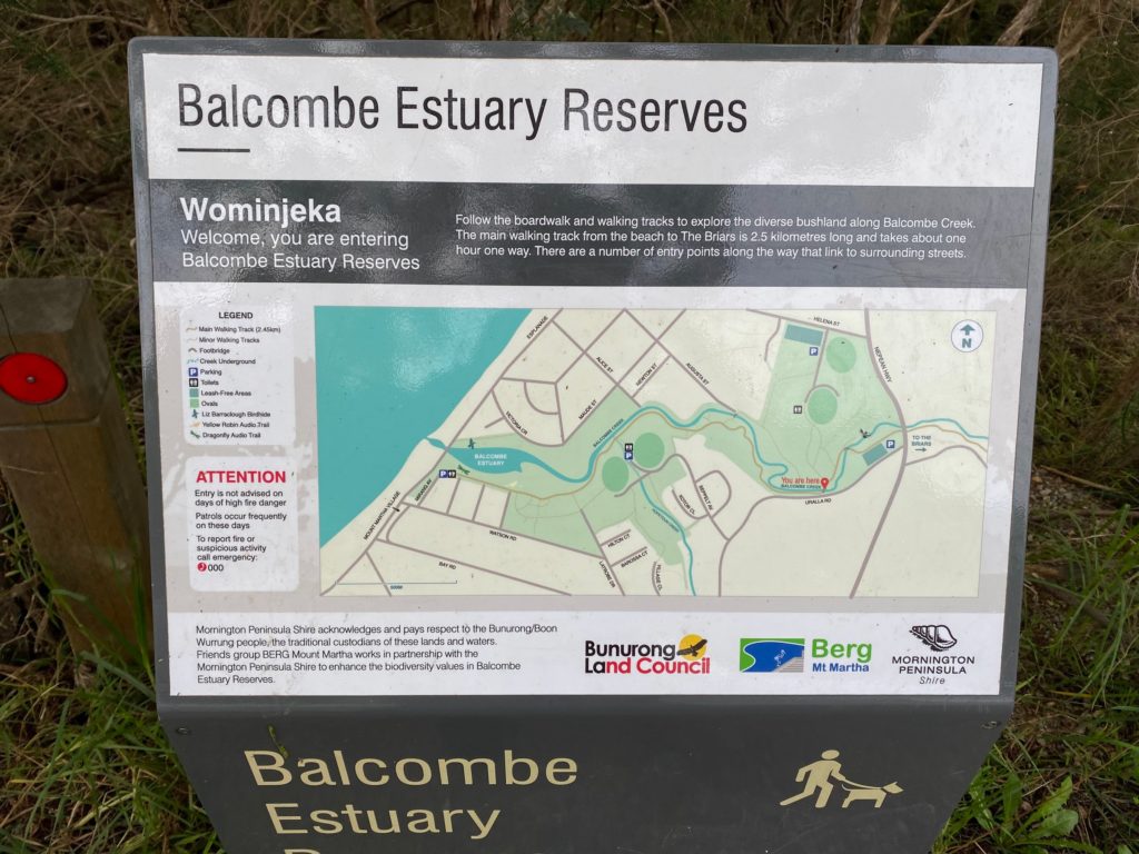
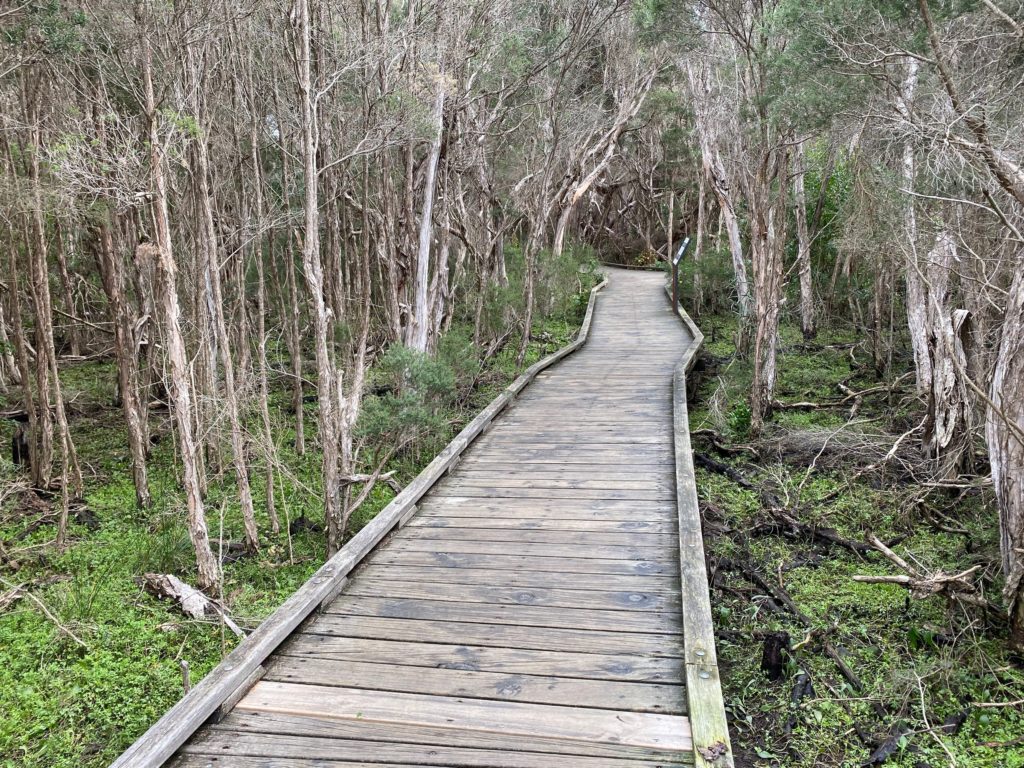
We headed to Balcombe Estuary Boardwalk next.
The sign reads:
Balcombe Estuary Reserves Wominjeka Welcome, you are entering Balcombe Estuary Reserves
Follow the boardwalk and walking tracks to explore the diverse bushland along Balcombe Creek. The main walking track from the beach to The Briars is 2.5 kilometres long and takes about one hour one way. There are a number of entry points along the way that link to surrounding streets.
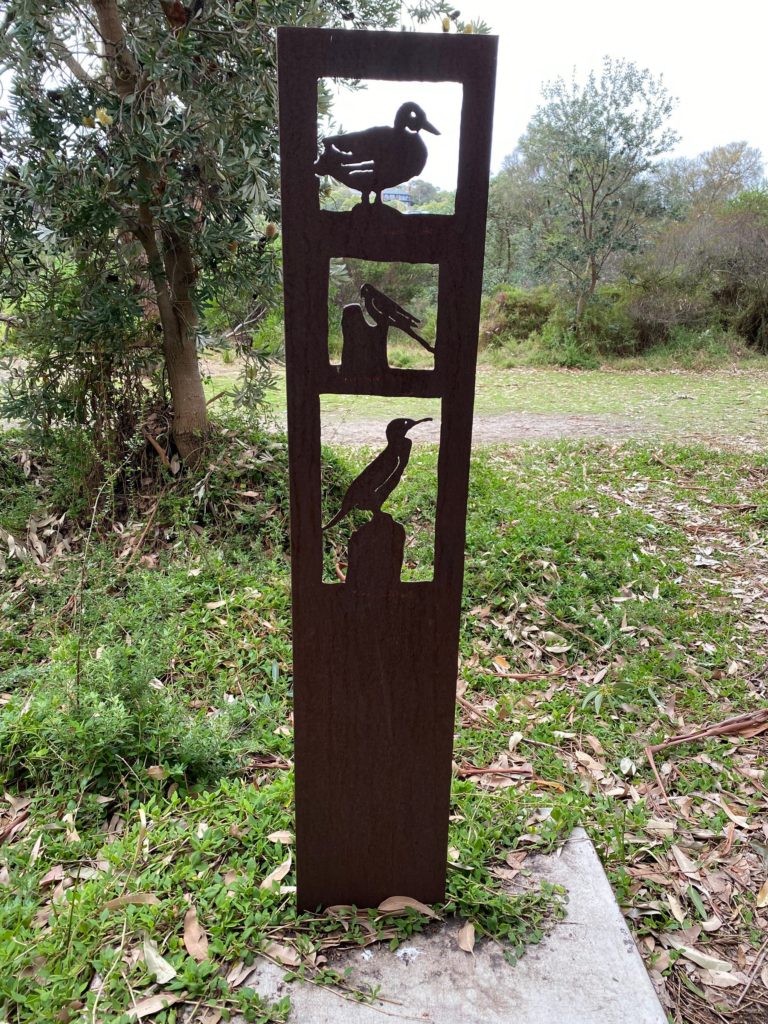
Infosign
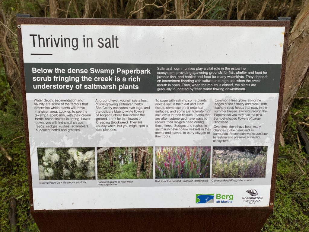
The sign reads:
Thriving in salt Below the dense Swamp Paperbark scrub fringing the creek is a rich understorey of saltmarsh plants.
Saltmarsh communities play a vital role in the estuarine ecosystem, providing spawning grounds for fish, shelter and food for juvenile fish, and habitat and food for many waterbirds. They depend on intermittent flooding with saltwater at high tide when the creek mouth is open. Then, when the mouth is closed, the plants are gradually inundated by fresh water flowing downstream.
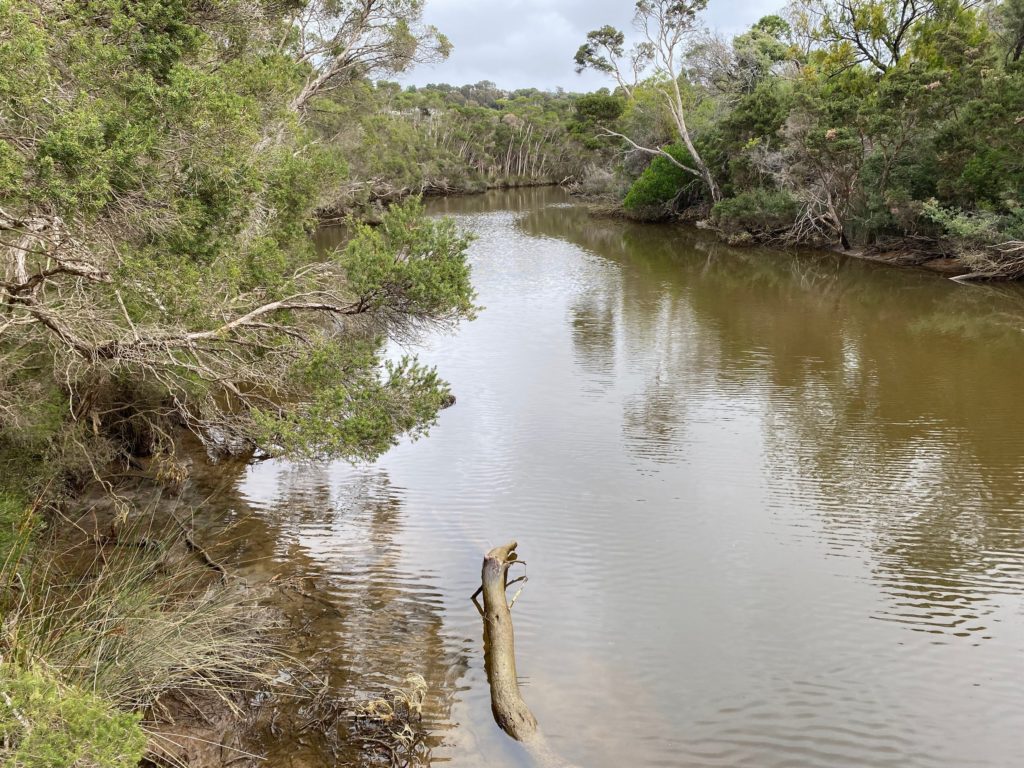
Balcombe Creek
We walked on a quiet street to get back to the Mornington – Mt Martha Foreshore Reserve.
We walked 12 km total. It took us 4 hours to complete the walk, including lunch break.
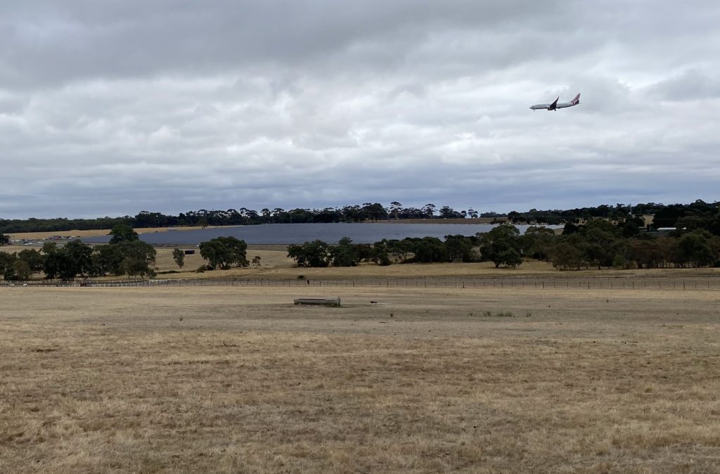
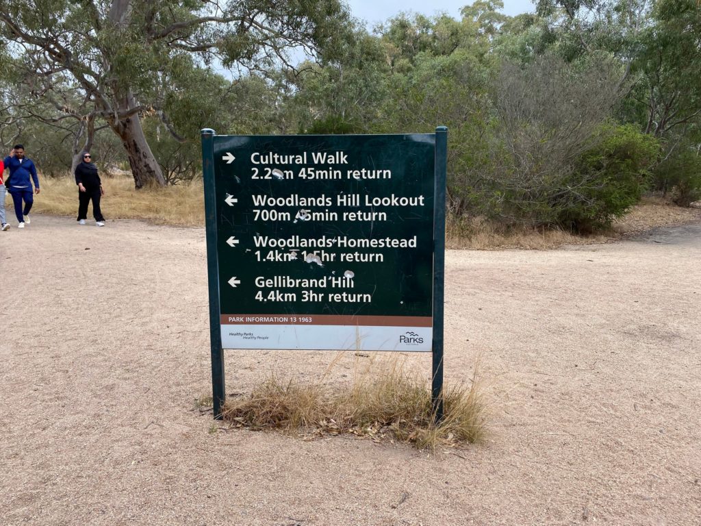
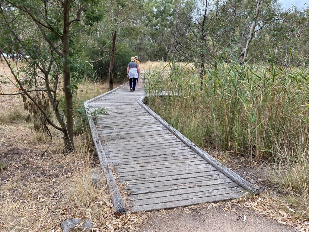
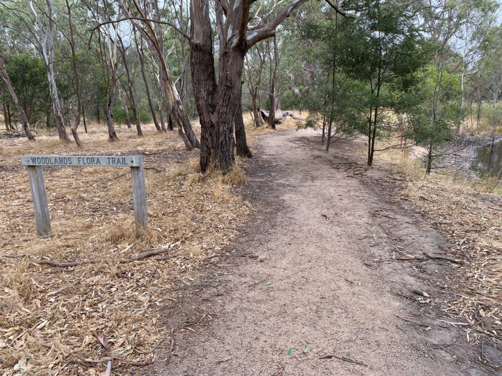
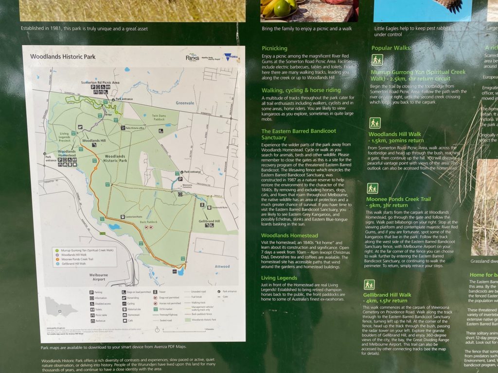
Woodlands Historic Park is located in Greenvale, not far from Melbourne Airport.
We took our dog for a walk there on Sunday.
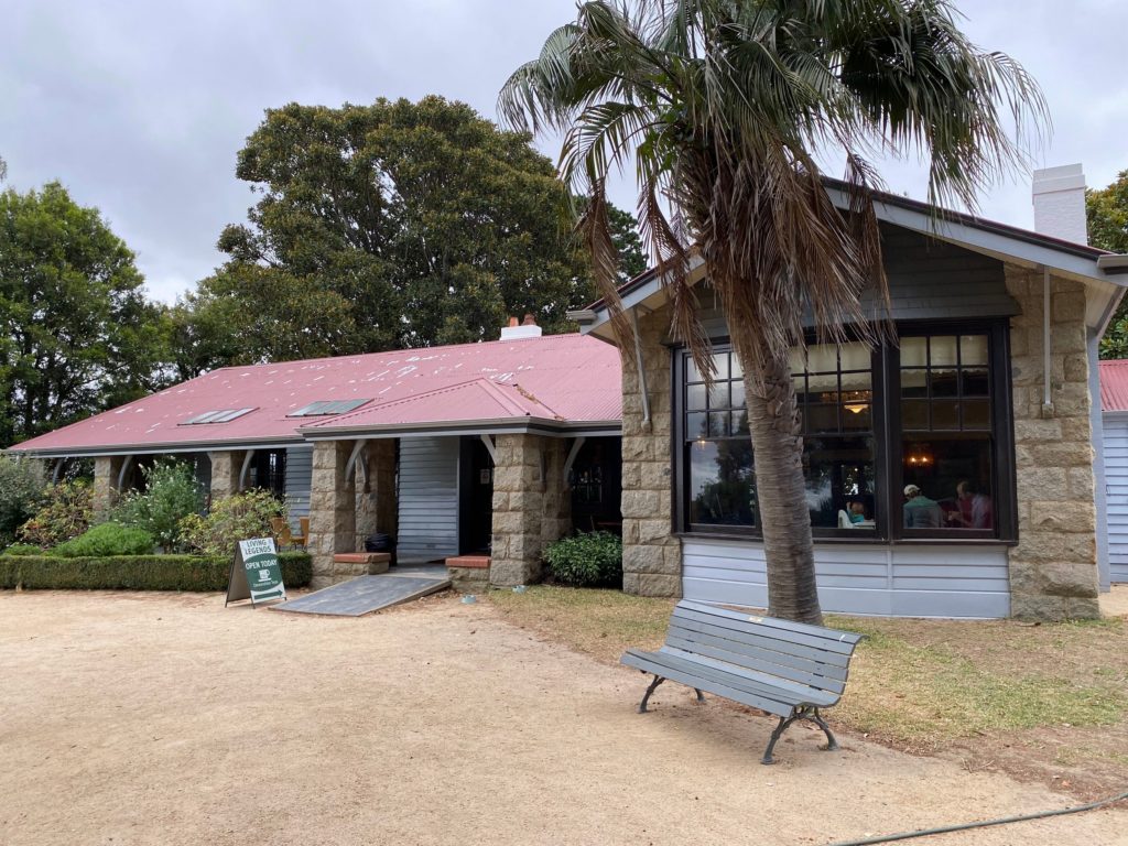
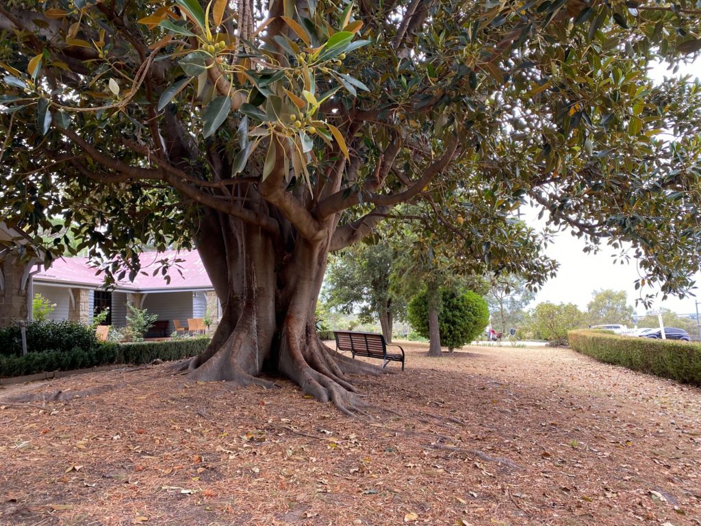
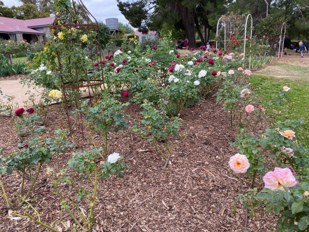
We started from Woodlands Homestead.
They serve Devonshire tea here.
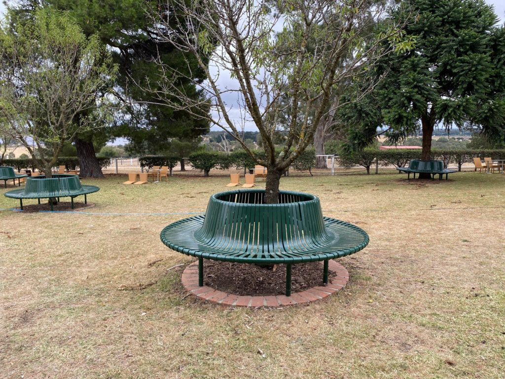
Metal benches
Interesting design of benches around trees.
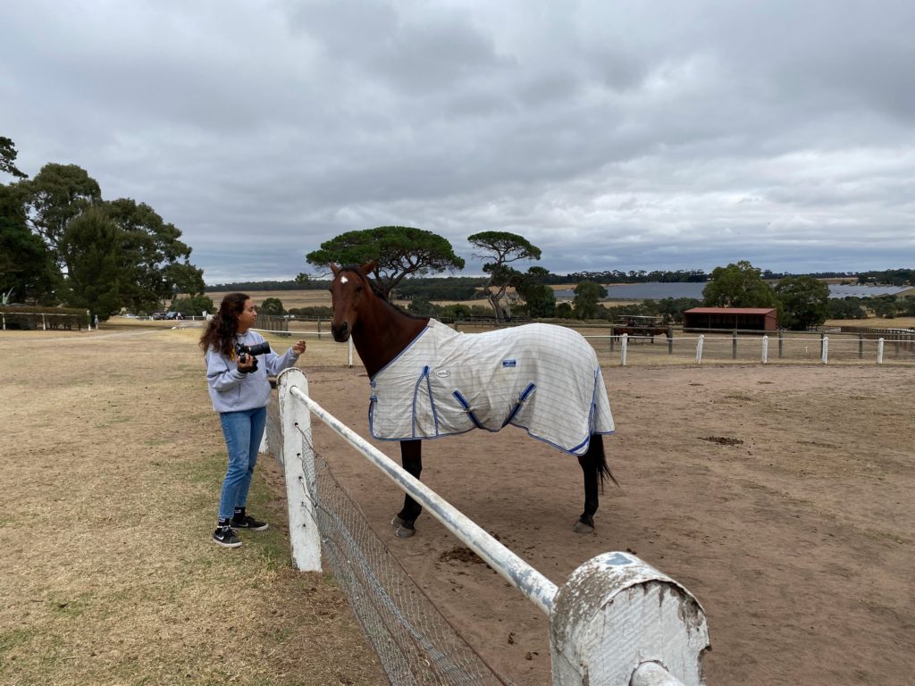
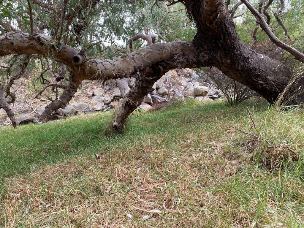
Just in front of the Homestead are real Living Legends! Established to bring retired champion horses back to the public, the front paddocks are home to some of Australia’s finest ex-racehorses.
The airport is nearby. You can also see a solar farm.
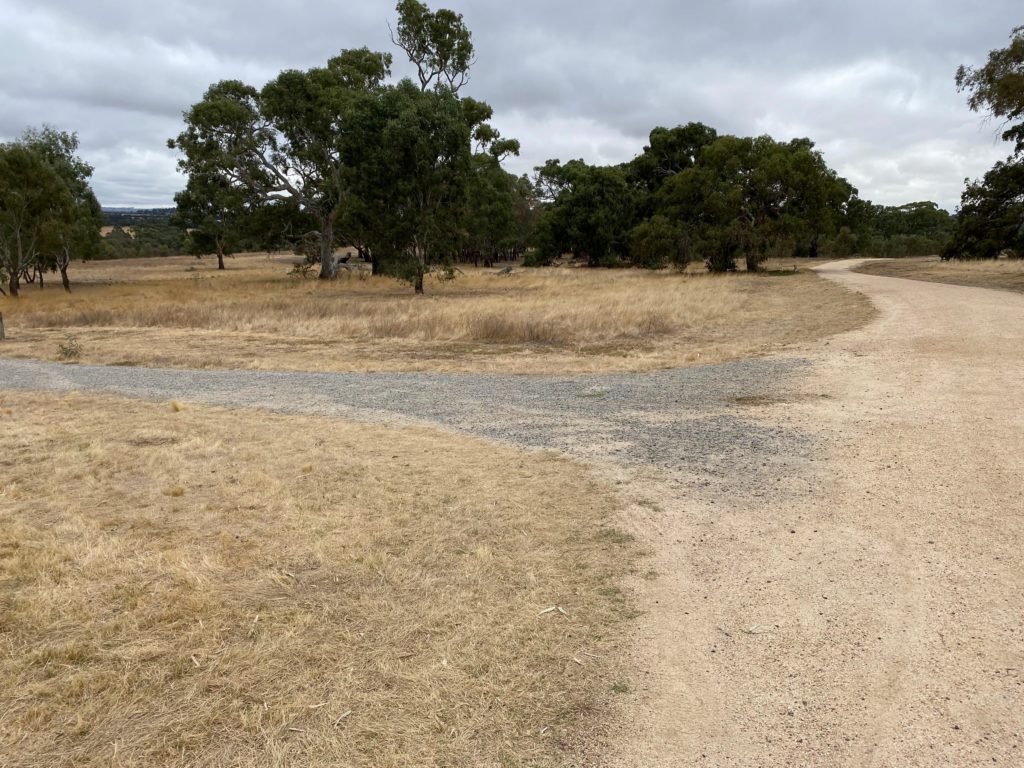
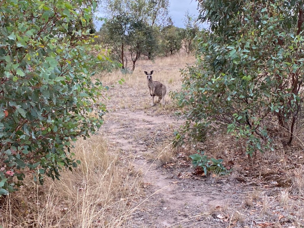
A multitude of tracks throughout the park cater for all trail enthusiasts including walkers, cyclists and in some areas, horse riders. You are likely to view kangaroos as you explore, sometimes in quite large mobs.
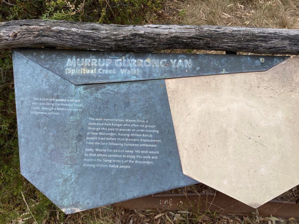
The sign reads:
MURRUP GURRONG YAN (Spiritual Creek Walk)
This 2.5km self-guided walk will take you along the Moonee Ponds Creek, through a landscape rich in Indigenous culture.
The walk memorialises Wayne Drew, a dedicated Park Ranger who often led groups through this area to provide an understanding of how Wurundjeri, Kurung-Willam Balluk people lived before their dramatic displacement from the land following European settlement.
Sadly, Wayne has passed away. His wish would be that others continue to enjoy this walk and explore the living history of the Wurundjeri, Kurung-Willam Balluk people.
Information sign
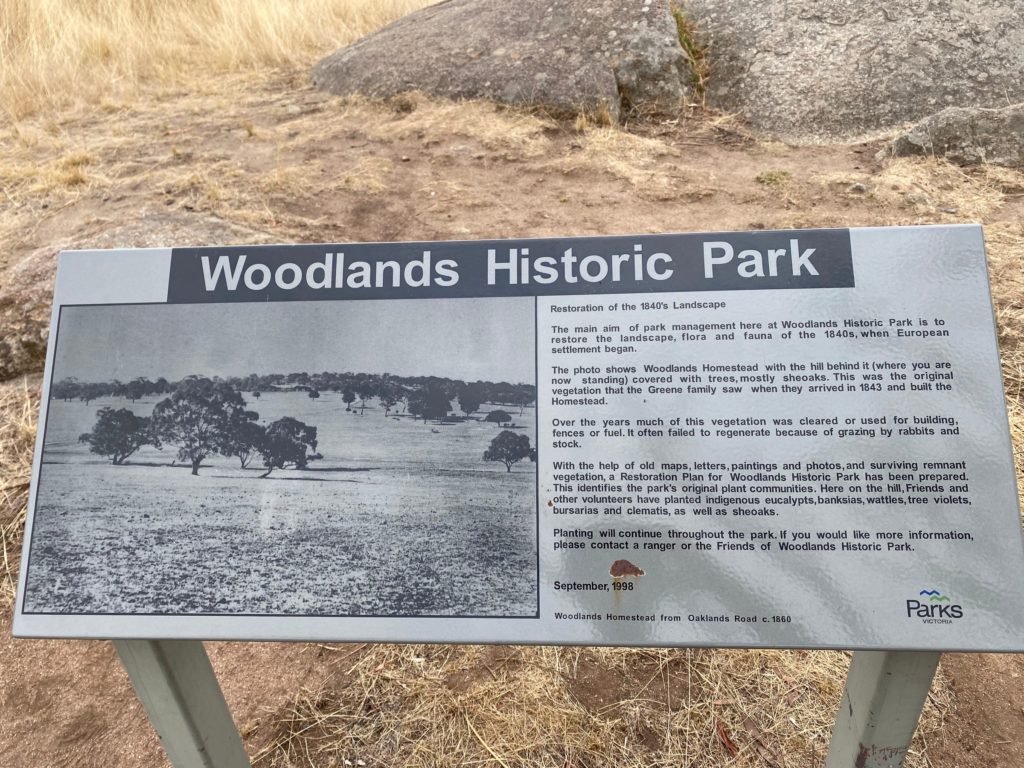
Restoration of the 1840’s Landscape
The sign reads:
The main aim of park management here at Woodlands Historic Park is to restore the landscape, flora and fauna of the 1840s, when European settlement began.
The photo shows Woodlands Homestead with the hill behind it (where you are. now standing) covered with trees, mostly sheoaks. This was the original vegetation that the Greene family saw when they arrived in 1843 and built the Homestead. Over the years much of this vegetation was cleared or used for building, fences or fuel. It often failed to regenerate because of grazing by rabbits and stock.
With the help of old maps, letters, paintings and photos, and surviving remnant vegetation, a Restoration Plan for Woodlands Historic Park has been prepared. This identifies the park’s original plant communities. Here on the hill, Friends and other volunteers have planted indigenous eucalypts, banksias, wattles, tree violets, bursarias and clematis, as well as sheoaks.
We walked 5.5 km total. It took us 1 hour and 20 minutes to complete the walk.
One weekend in South Gippsland, I was eager to find somewhere new and dog-friendly to take a stroll. We’ve taken our golden retriever to the George Bass Coastal Walk in Kilcunda, and dog-friendly beaches like Inverloch and Sandy Point.
I came across the Loader Walk in my research, but there wasn’t a great deal of information online – this just meant we just had to try it out for our selves.
If you are travelling from Melbourne towards Wilsons Promontory, the walk is located just after the town of Fish Creek and before Foster.
Once you leave the freeway after Fish Creek, the road becomes steep, narrow and unpaved. We made it up in a hatchback, but the route is not recommended for caravans or motorhomes.
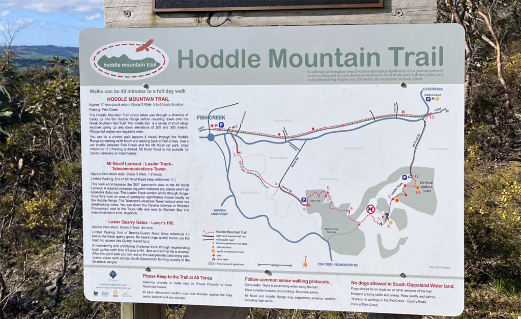
Upon arrival, there is a clear map and signage before you begin the walk. From the map, I learnt that the Loader Walk is part of a larger trail called the Hoddle Mountain Trail, which takes 5-6 hours if you complete the entire circuit. I’ve come into the habit of always taking a photo of the map before we start, just in case I need it later down the track.
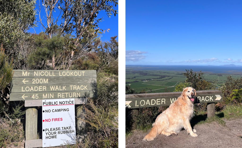
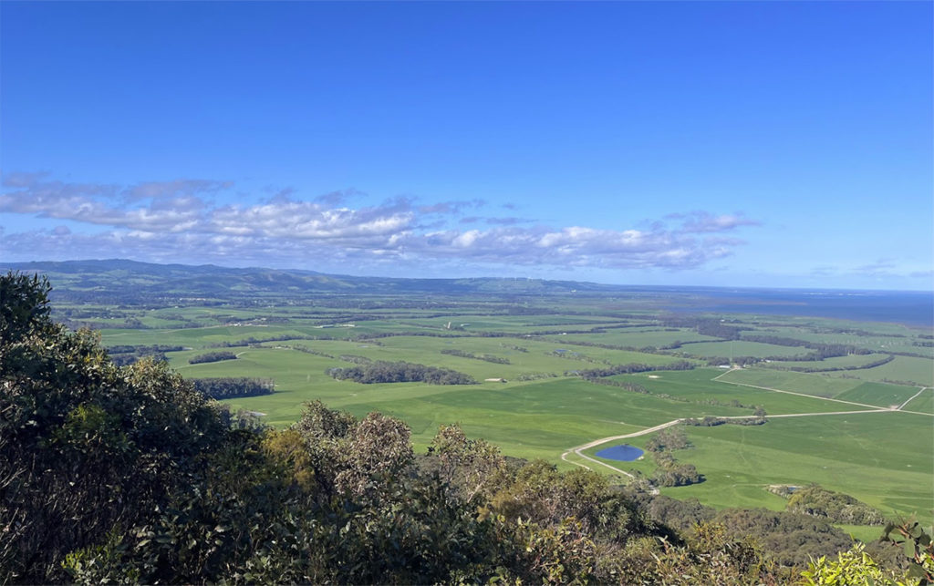
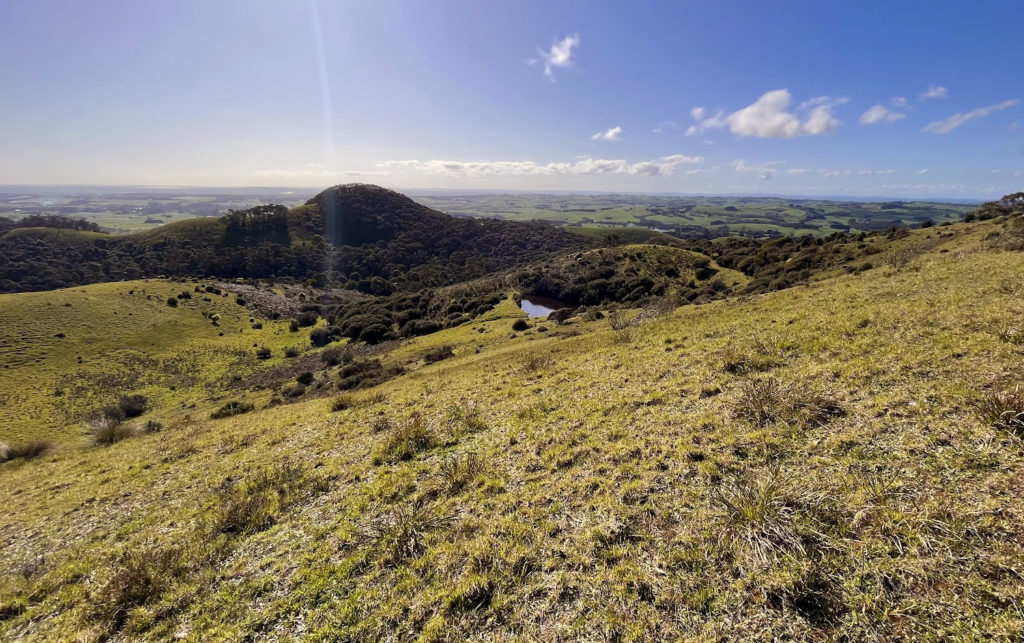
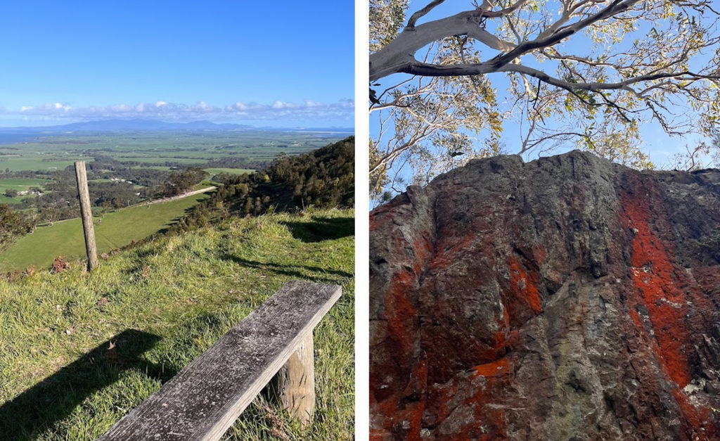
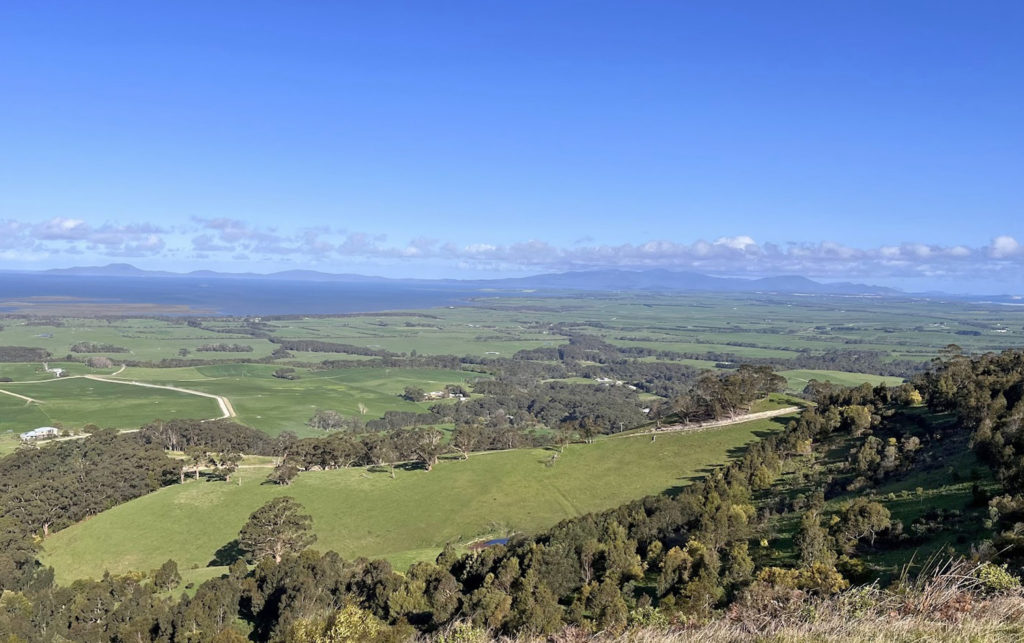
For those who don’t have time for a walk, there is a great lookout just 200 metres into the walk called Mount Nicoll Lookout. It gives you sweeping views across the green fields, all the way to the coast and Wilsons Prom.
After the lookout, the track traverses the iconic rolling green hills of South Gippsland. I’ve always admired the landscapes on the winding drives throughout the region, so it was incredible to be able to walk amongst it and stop and admire the view.
After this picturesque section, there is a steep downhill which leads into constant, short inclines and declines amidst shadier bush sections.
It added some diversity to the walk, but our dog has weak hips and knees, so I don’t think he enjoyed this section due to it being a little slippery on gravel, downhill parts.
The walk comes back out to more farmland and coastal views. These sections have no shade, so make sure to be sunsmart and bring plenty of water.
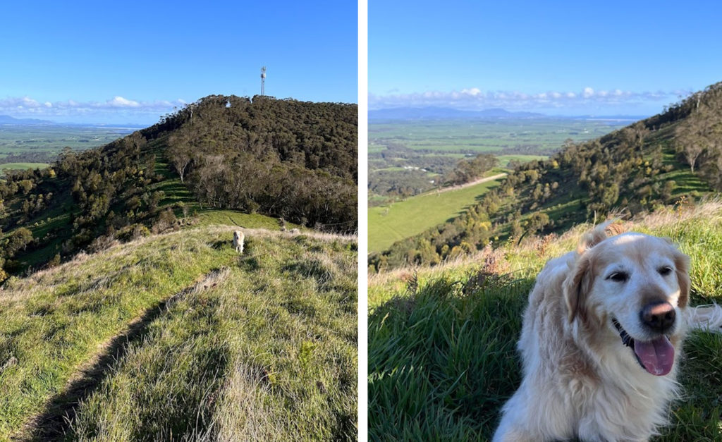
The next landmark was the Telecommunications Tower, which is further south. We could see it in the distance but our dog was getting quite tired from the inclines and the harsh sun.
We decided to give him a rest and to turn back, as we thought the view from the tower might be similar to what we could already see.
The initial map notes that a walk from the carpark to the Telecommunications Tower should take 1-2 hours return.
The walk is a great option for those with and without dogs. The inland and coastal scenery is breathtaking, there are enough inclines to make it interesting and you can turn around at any point to customise the walk to your level of difficulty. Even if you make it a short walk, you’ll see quintessential Gippsland views.
We did the walk in spring, after a wet winter, so the farmland was especially lush. I recommend doing it in spring, as there is more likely to be mild weather. But remember that the sun can get quite strong in South Gippsland, so wear a hat and sunscreen too.
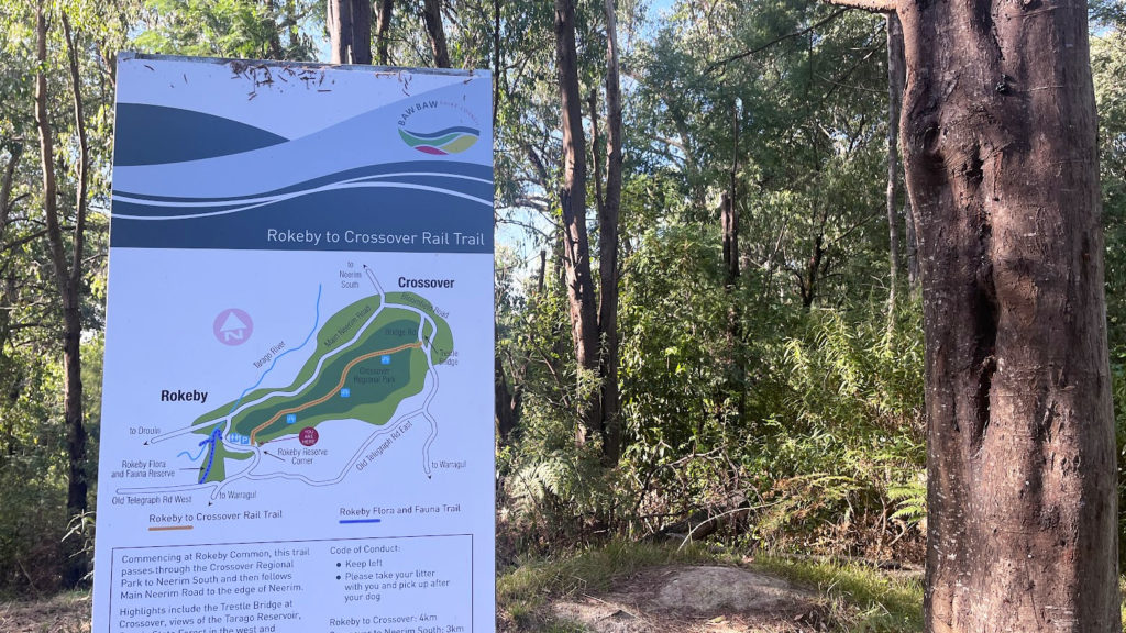
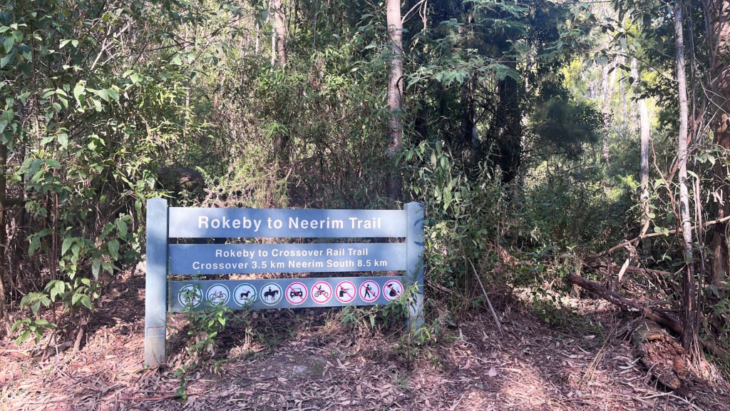
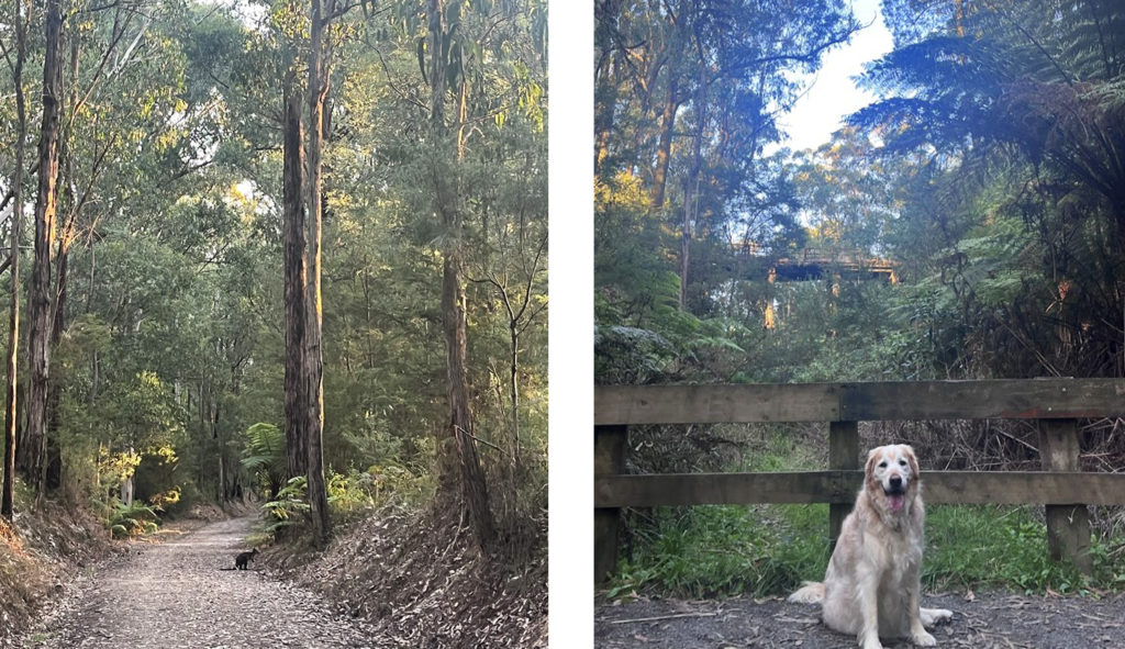
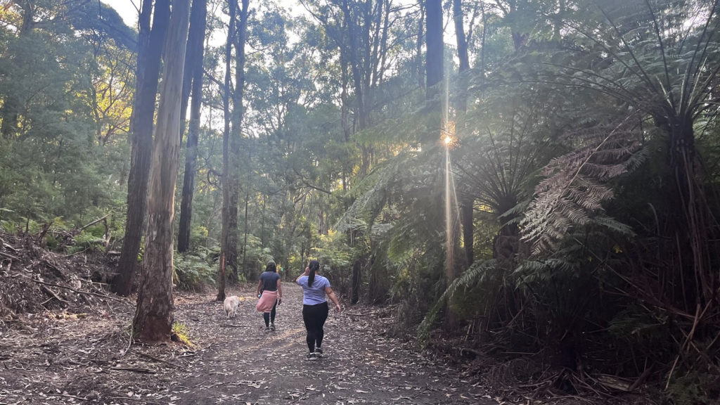
Just an hour and a half out of Melbourne, you’ll find the leafy little town of Rokeby in West Gippsland.
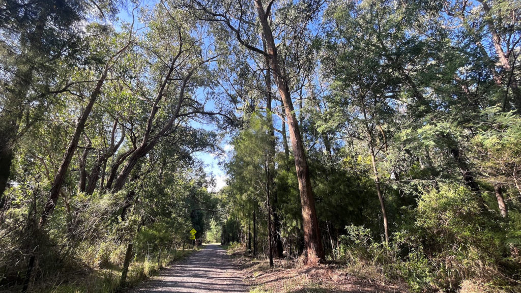
The Rokeby to Crossover Rail Trail is about 4km one way, and is the perfect walk for those who don’t like inclines.
As we had an elderly person and 10 year old dog with us, it was a suitable trail for everyone. We spotted quite a few people with dogs on lead and some joggers too.
The path is wide, straightforward and mostly flat. The whole trail is flanked by the tall trees of Crossover Regional Park, making it feel cool and shady.
The walk is similar the whole way except that every now and again, you’ll glimpse someone’s farmland or private property and rolling green hills.
There are also small paths that diverge off the main one. There was little signage but I assumed they might be mountain biking paths.
There were three or so benches along the track, which helped the eldery person in our group take a reasonable number of breaks.
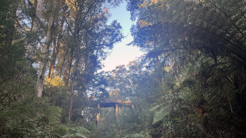
At the end of the track, you reach an old trestle bridge in Crossover, which looks quite old, but has a mysterious, abandoned look as it is framed by towering, leafy trees.
At this point of the track, there was also signage pointing to another carpark, indicating you could also start the walk from Crossover. You can also continue onto Neerim South (3km from Crossover) and then Neerim (5.6km from Neerim South), which makes up the Rokeby to Neerim trail.
As it was nearing sunset, we took a few photos of the bridge and made our way back the way we came.
For those who want to add some entertainment to the walk, you can download the Geocaching app and embark on something akin to a treasure hunt. The app noted there was a cache near an intersection with a seat we were resting at, but we were unsuccessful in finding it.
As the sunlight was disappearing, the last rays peeked between the trees on our return walk. It added a sense of tranquility to the journey. We also spotted a few wallabies, who jumped off into the forest as we got closer.
The map at the start of the walk also noted you can also veer off to explore a short Rokeby Flora and Fauna Trail, which has some interpretive signage.
If you are ever in West Gippsland, the walk is a relaxing activity to add to your itinerary, especially if you have a family and dog. I think it would also be very great for families with bikes.
Make sure to time a visit with the Rokeby Market, which runs on the second Saturday of each month from September – May. It’s quite large compared to some smaller country markets. It has capacity for 100 stalls, which are inspired by the motto, “Make it, Bake it, Grow it, Breed it”. Rokeby Reserve, where the market is held, is also the beginning of the Rokeby to Crossover walk.
The walk is also about fifteen minutes from Warragul, where you can refuel at plenty of cafes and eateries.